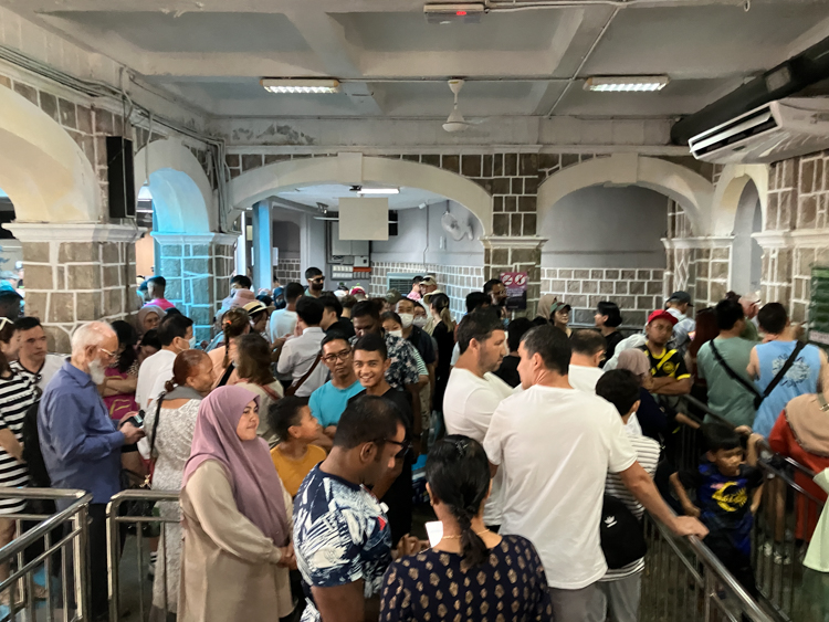
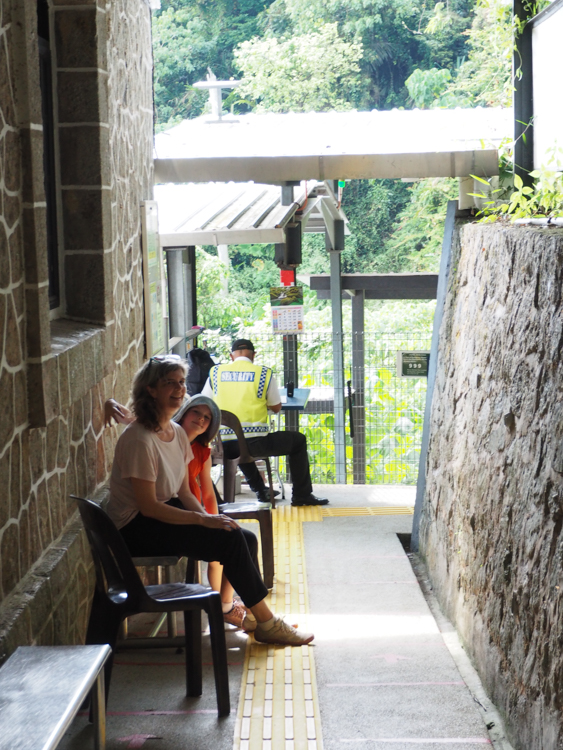
After an early breakfast in Georgetown, we caught a taxi to the Penang Hill railway station. We had bought advance ‘express’ tickets which allowed us to skip the queues. Even though this isn’t peak season, and on arrival the queue to buy tickets was practically empty, the queue of people with tickets numbered in the hundreds and we were glad to skip past them onto the train.
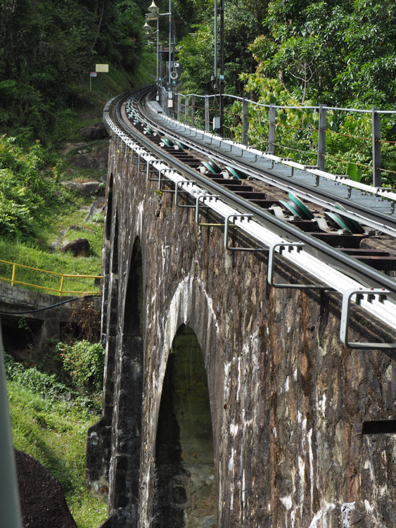
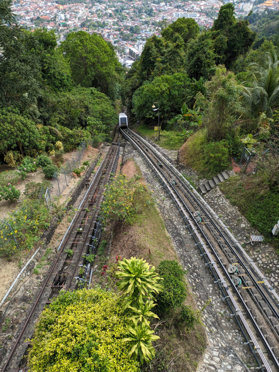
The current train is a Swiss-made funicular, pulled up the mountain by means of a cable, which has been operating in several different forms since the 1920s. The railway was originally built to allow the British colonial community an opportunity to enjoy the air at the top of the mountain, which is five degrees cooler than that of the city below.
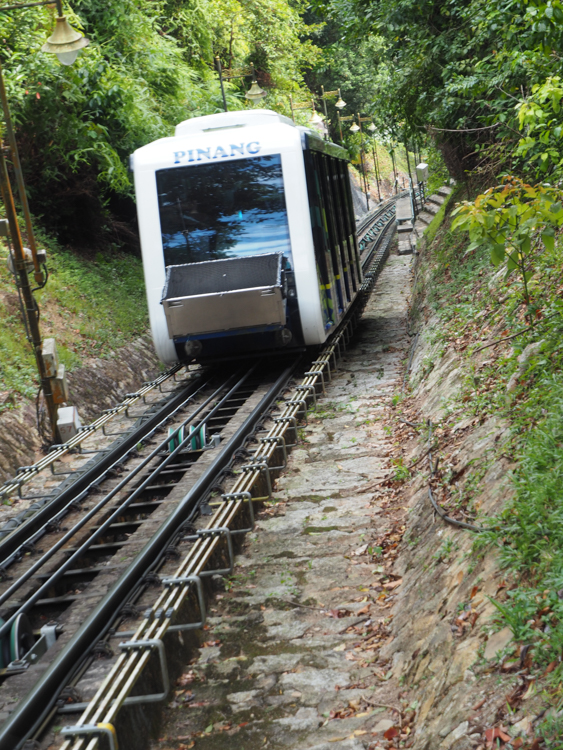
As an attraction, the train itself is more impressive from the outside than the inside. The carriages are crowded and you can’t see much beyond some rock infrastructure and people’s arms and bags, but it does get you to the top quite quickly.
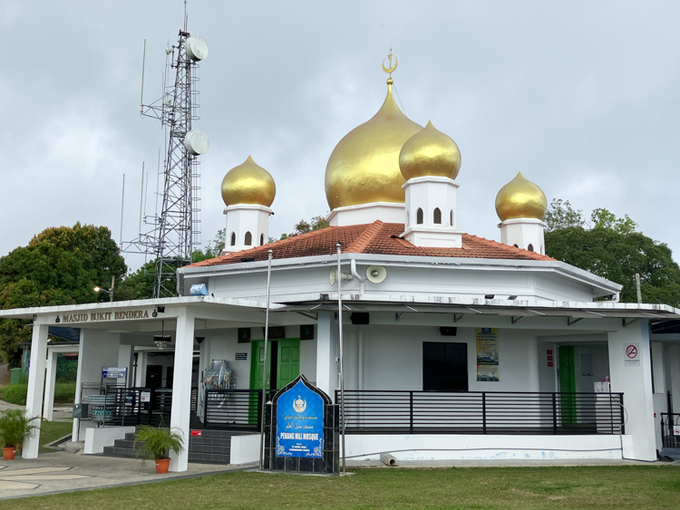
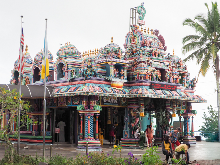
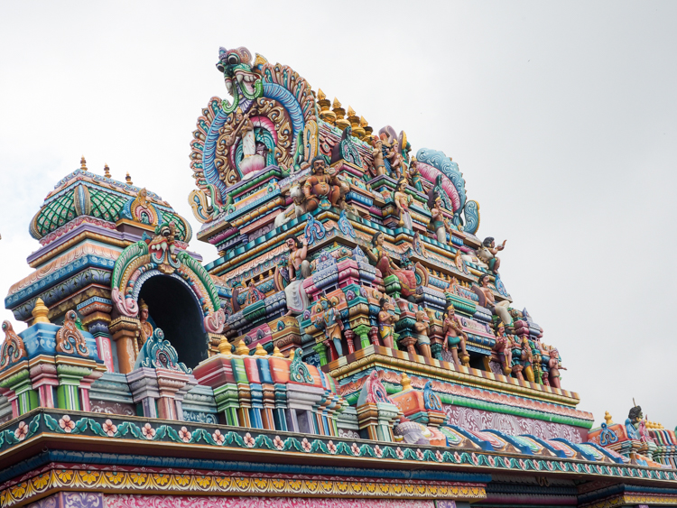
There are a couple of active religious buildings at the top of Penang Hill. There are the golden domes of the Penang Hill Mosque, which is mainly used by stall-holders and railway workers on Penang Hill, and the Hindu temple Sri Aruloli Thirumurugan, which is one of the oldest in Penang, and very impressive in the ornate Dravidian architectural style.
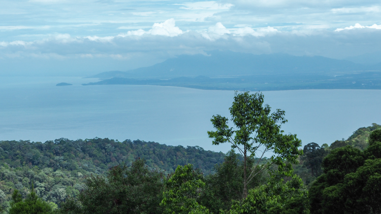
Penang Hill is also home to a number of ‘attractions’ of the ‘build it and hopefully they will come’ variety, with subjects largely unconnected to the historical rain forest site. However, The Habitat is worth a visit, a nature walk through the tropical rain forest, including an impressive suspension bridge above the canopy, and a ‘tree-top walk’ giving epic views across the island, with Langkawi and even mainland Malaysia visible in the distance.
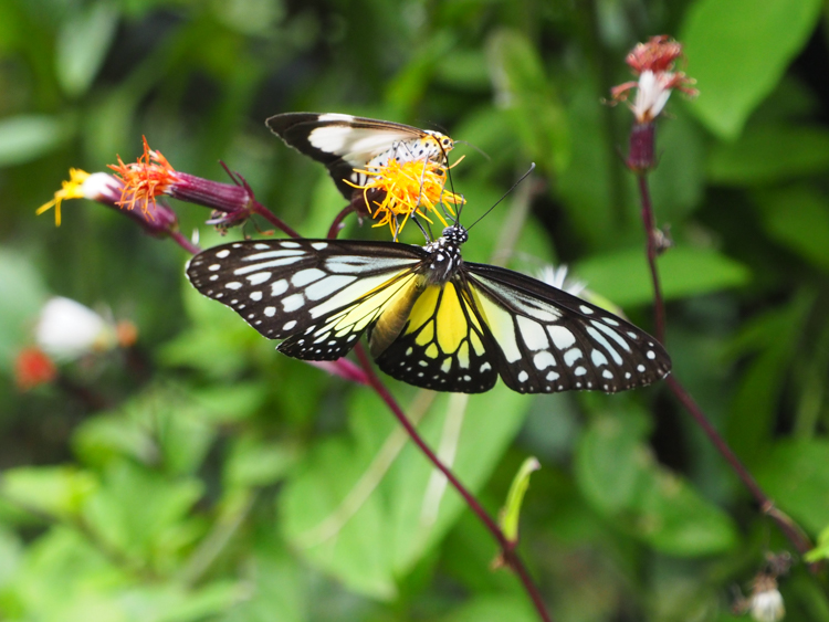
The nature trail has many little nooks and paths to explore, and is quite lovely. A lot of effort has been put in to attract butterflies. Berrima and I spent some time exchanging whistles with a blue bird perched on a branch above us (perhaps a Malaysian Blue Flycatcher?), and enjoying some quirky touches such as swinging benches looking out over the forest canopy.
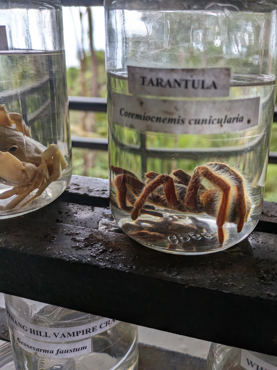
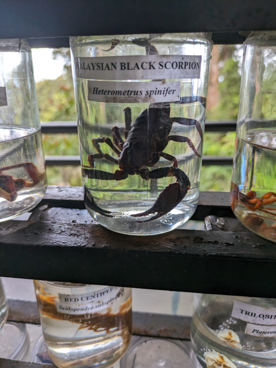
In one small building was an interesting collection of endemic invertebrates, pickled in jars.
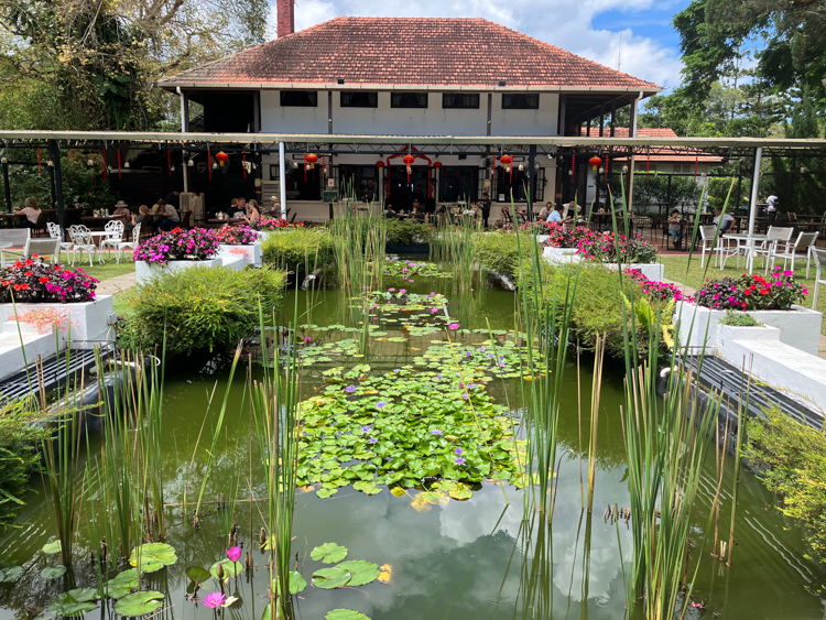
By then it was lunchtime, and we returned to the main complex. Most of the food stalls looked a bit touristy and ordinary, but I found a classic colonial-style open-air restaurant at the highest point, David Brown’s Restaurant, which was an oasis of calm above the hubbub below.
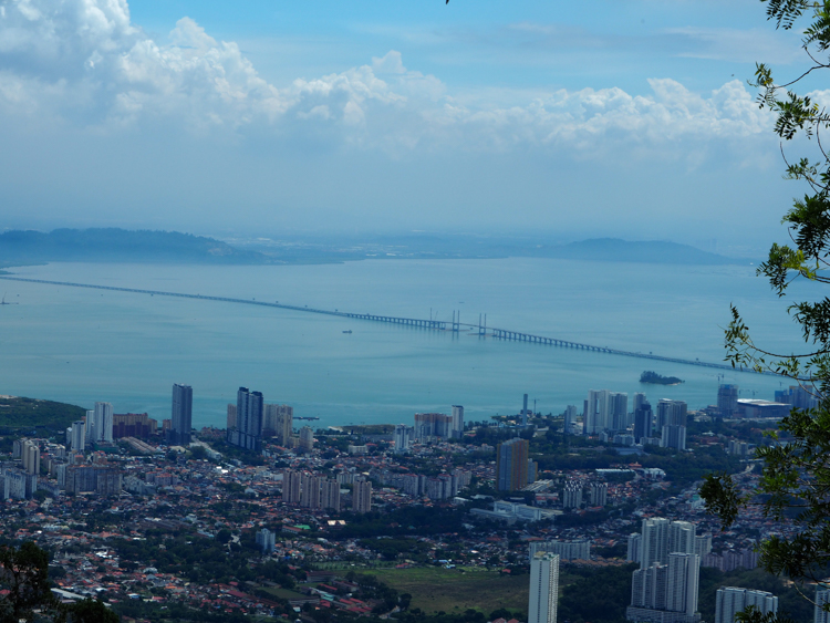
We were escorted to our linen-clothed table by an impeccable waiter, where we perused our menus while enjoying views across the Penang Strait.
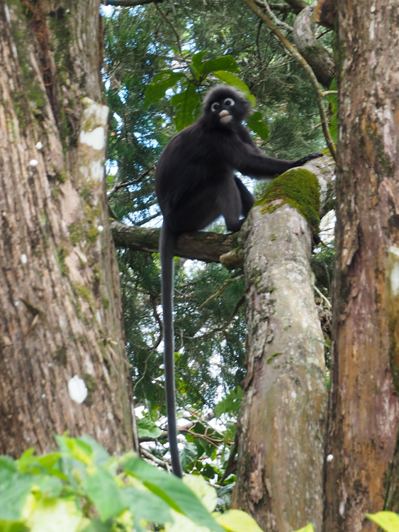
We sat outside, but under a shade sail, which allowed us to watch a troupe of spectacled lemurs playing in the tree tops. I ordered nasi lemak… I always order nasi lemak… but rather than being made with beef rendang and prawns, this one gloried in a wagyu pattie and satay chicken. It worked rather well, and I was grateful for a Tiger beer too.

After a leisurely lunch, we descended back into the bustle. To be honest, it was clear from the infrastructure that it could be a lot busier in season, but to us it seemed pretty crowded. Our task was to find the hiking trail back down to the city, rather than having to pack into the funicular.
The signage was unclear about free activities such as walking, preferring to direct the consumer to paid attractions, and in the end, we asked a lady who was directing queues, and she suggested that we look for ‘Bypath A’ and follow it around until it connects to the trail to Middle Station. Following her directions, we did locate Bypath A, and at the head we did find a map of sorts, but in the event it bore only a slight resemblance to the actual terrain.
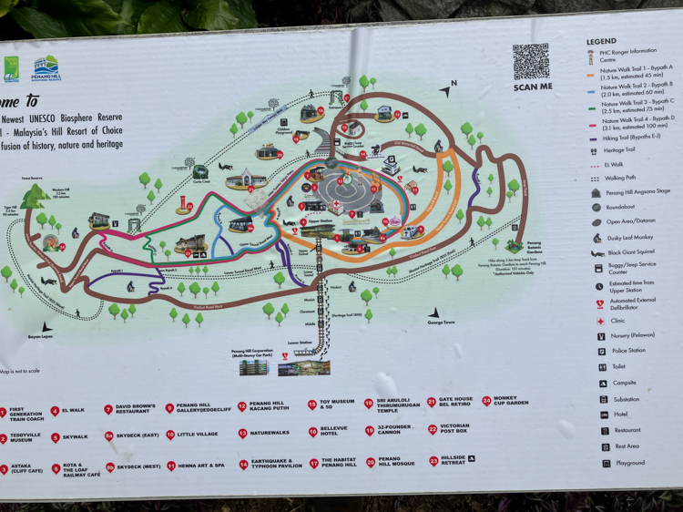
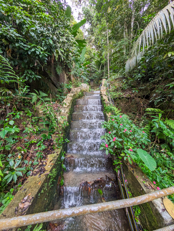
The top part of Bypath A is a nature trail that criss-crosses a number of storm drains, which is a lot prettier than it sounds.
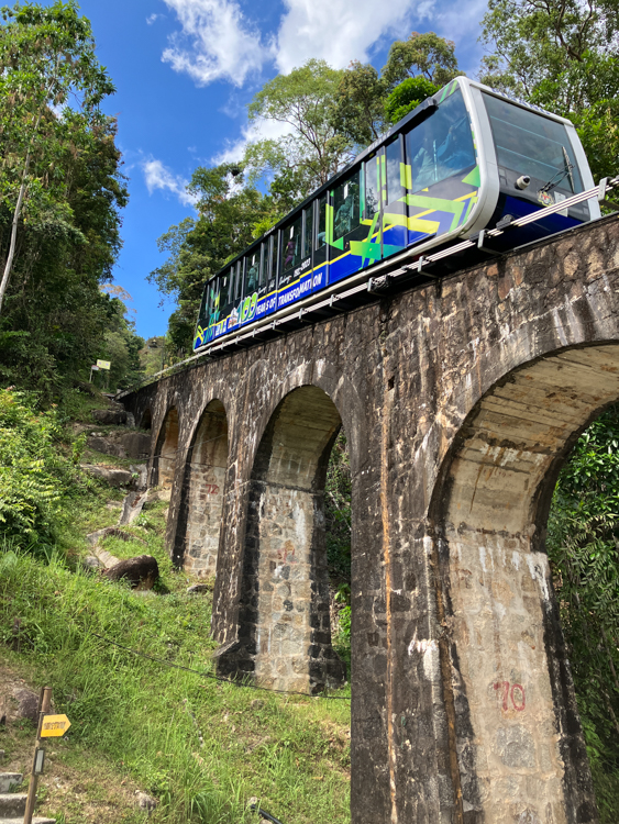
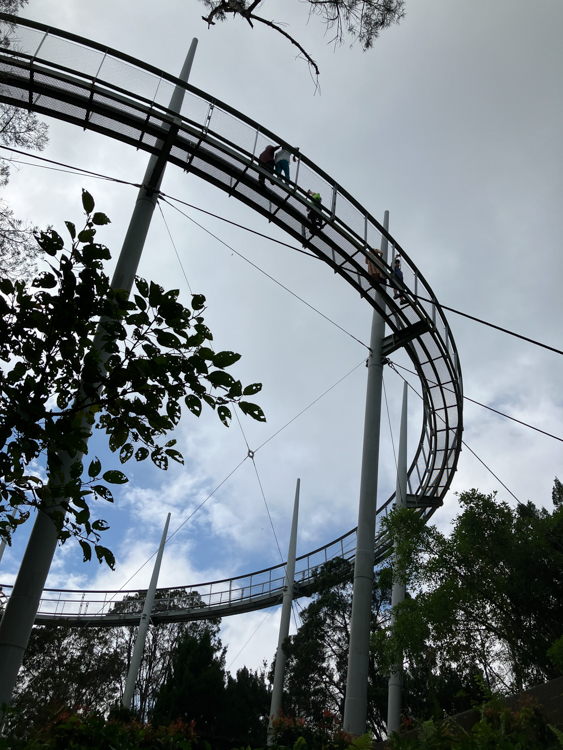
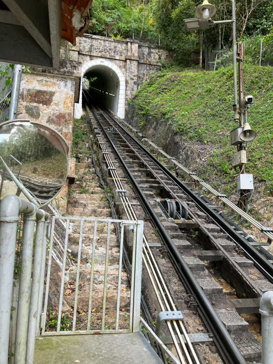
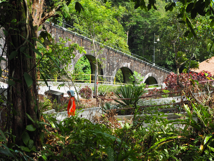
The marked trail soon petered out, and increasingly insistent signage directed us back up the hill toward retail opportunities. Stubbornly we persevered, and followed any downward-directed steps until we eventually popped out at Tunnel Station, a stop just for staff and residents. We cast around for another path, and then worked our way down to the similar Viaduct Station. This part of the trail gave us good close-up views of the impressive funicular infrastructure.
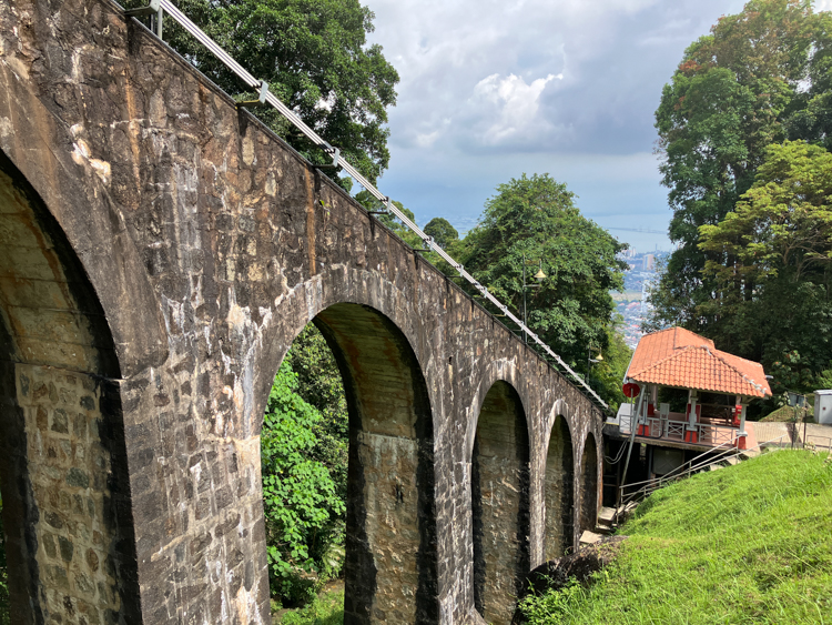
Our hit-and-miss progress continued until we came to a signpost for Middle Station, which was our ultimate destination. Historically, Middle Station was the intersection between Penang Hill’s upper and lower railways, where all passengers had to change trains. The modern train now runs top to bottom, but Middle Station remains as a request stop for those wishing to embark or disembark.
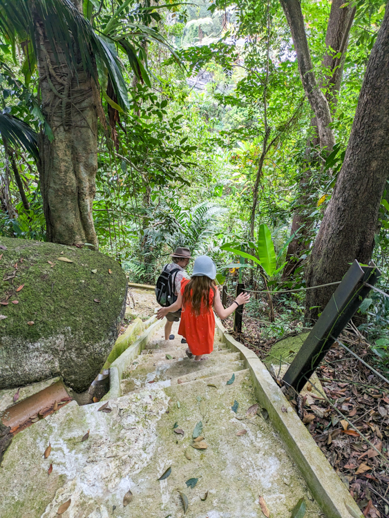
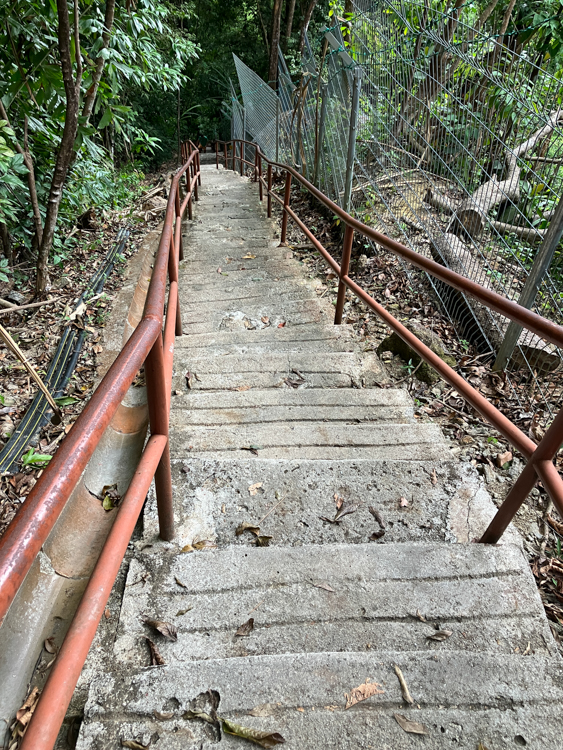
The signpost existed, but only vaguely indicated one of three trails. Two looked well-worn, but more resembled mountain-bike trails or possibly storm-water run-off. The third trail was covered in leaves as if it was less travelled, but had the benefit of being constructed of concrete steps. We chose this latter route, and followed it as it descended steeply through the rain forest. At about the time that we had gone too far to contemplate climbing back up, the path degenerated into a mud slide. Here and there, ropes had been fitted – at least, where they hadn’t been squashed by falling trees – so we continued to climb and clamber ever downwards.
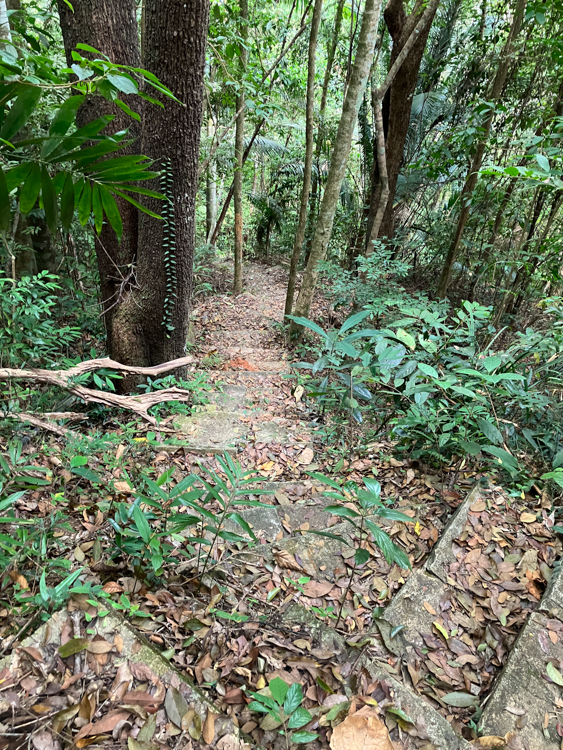
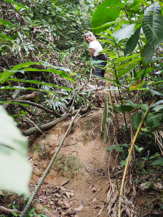
The mud slide eventually spat us out onto a well-trodden but still muddy trail. We spoke to a runner who confirmed that the paths are not easy to find, and that it was important to know which fork to choose.
Finally we encountered a sign to Middle Station, and the path turned to concrete, winding between houses and small farms.
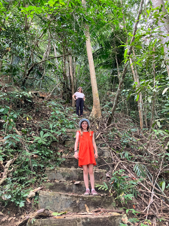
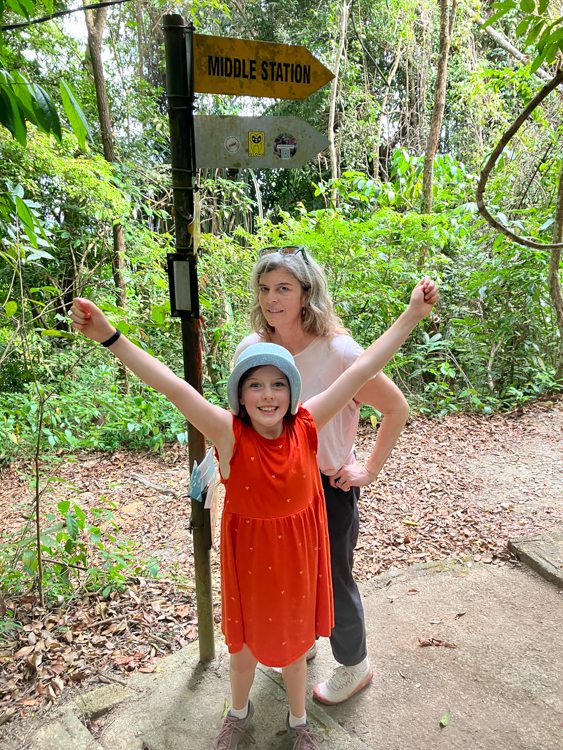
We arrived at Middle Station, where we could see where the new track had been built over the old, splitting off to join the newer upper section. A security guard explained that, although we could theoretically board any of the carriages that arrived at 15-minute intervals, he knew that they were all going to be full for at least the next hour.
The girls decided to wait, but I was keen to hike all the way to the bottom. I couldn’t see the path, but the guard took me to the top of the trail, which – like most of the path entry points – was thin and unmarked.
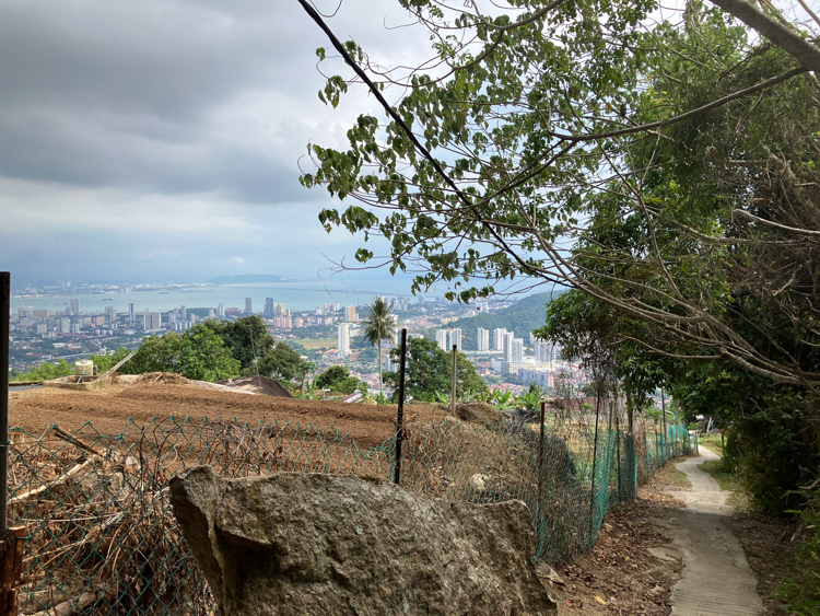
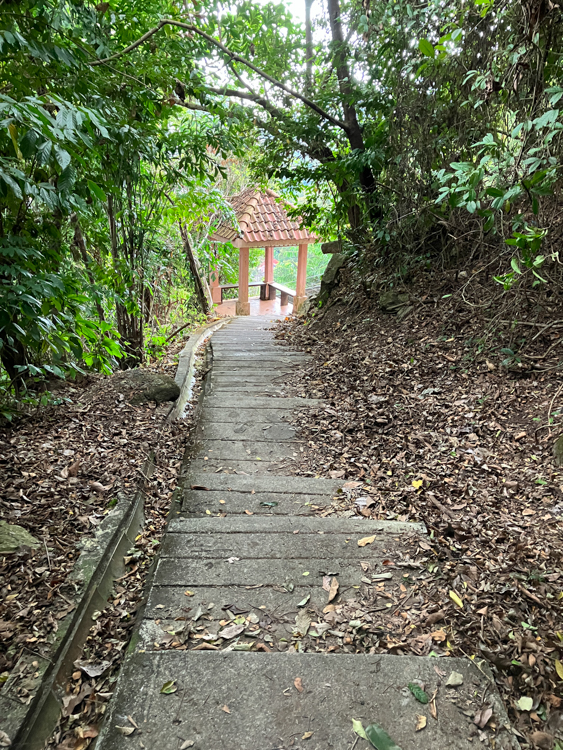
Once I got going, I could see a clear difference between the top path and the bottom path. In days gone by, many people used to hike up to Middle Station to catch the upper train, and this section is consequently well made and punctuated with little rest-stops with benches. This half of the walk even has a name, the Penang Hill Heritage Trail.
Going down the endless steps, I met a surprising number of people coming up. Some appeared to be doing the hike for the exercise, but many appeared to be either walking home from the office, or walking up to work at the top. They were old, young, men, ladies. Some of them were striding out, others appeared to be watching TV on their phones.
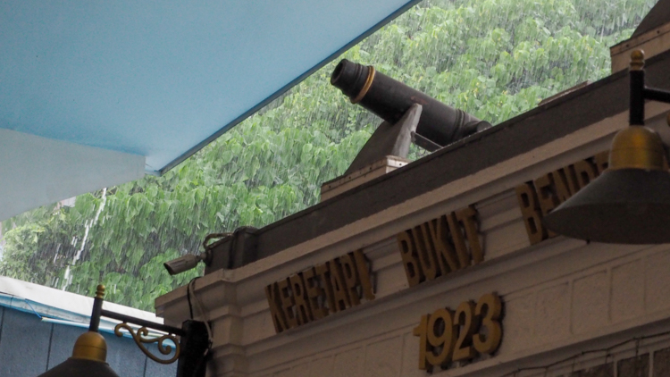
About an hour down from Middle Station, the path ended in the car park of the Penang Hill Jade Temple. At this point, the heavens opened to a deluge of monsoon proportions. I sheltered under a stand of bamboo for a while, but soon realised that it wasn’t going to stop any time soon.
I wrapped my camera in my hat, and splashed my way town to Lower Terminal Station; the path was ankle-deep and I was instantly saturated.
It was another hour before the girls arrived, having finally squeezed into a train carriage, but I spent the time standing in front of a huge free-standing air-conditioning unit, and by the time they arrived, I was almost dry.