Hiking the Three Capes Track – Day Four

Each cabin complex on the Three Capes Track has an identical dorm setup, so every night I was sharing with the same people in a carbon-copy of the same dorm cabin. As usual, I had claimed the bunk that nobody else wanted, in the darkest corner farthest from the door, which I crawled into like a yacht’s berth. This gave me my own corner of darkness while the rest of the guys were bumbling around with their bright head torches.

I am sure that head torches are wonderfully useful for those who choose not to let their eyes become accustomed to the dark, but I find them annoying in company because humans are always moving their heads, looking around, momentarily distracted by any noise or motion, and shining their lights into the eyes of anybody they want to talk to. At least with a small pencil torch, it remains focussed on the task in hand, and doesn’t bother anyone else.

I woke as usual six hours after going to sleep, in this case at one in the morning. Rather than get up, I just lay and listened to the wind hammering past outside. The forecast was for a blustery day with 50km/h gusts, and it certainly sounded like it as the occasional flurry of rain pattered on the tin roof.

By seven, I was up and about and making Aeropress coffee. What a fine device this is; lightweight, neat, unbreakable, and capable of quickly extracting every last millilitre of caffeine from a few spoonfuls of grounds. The second-most common comment on my travel kit this week has been, “Oh I wish I’d brought my Aeropress too” (the most common comment was, “Oh I wish I’d brought wine and rum too…”)

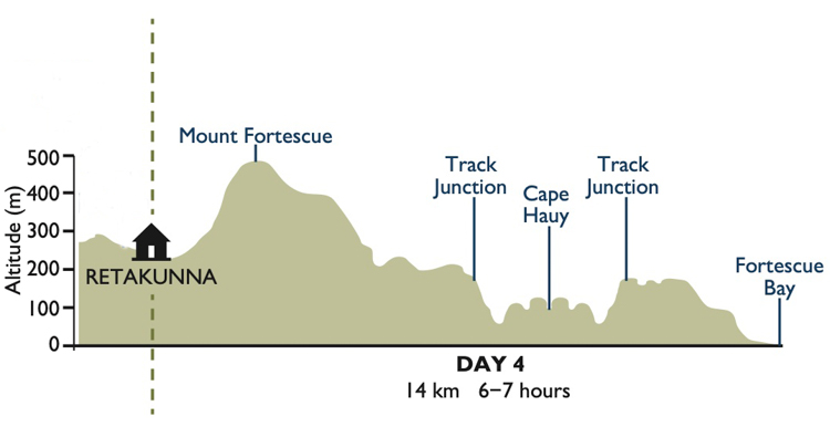
The fourth day of the Three Capes Track is acknowledged to be ‘the hard day’. Not only does it begin with the climb to the top of Mount Fortescue, a vertical rise of just under 250 metres, but it also has the psychological stressor of a scheduled bus waiting at the end of the walk to take us back to Port Arthur. We had booked on the later of the two buses, but nevertheless, the timetable was a niggle at the back of the mind.

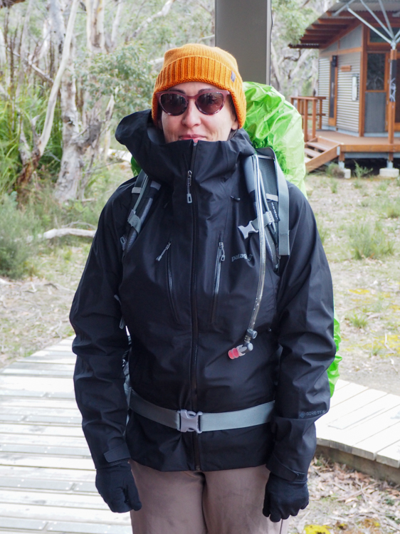
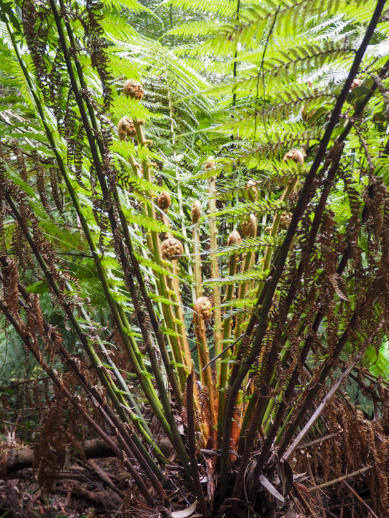
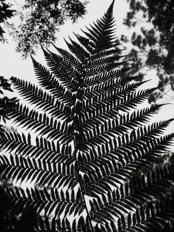
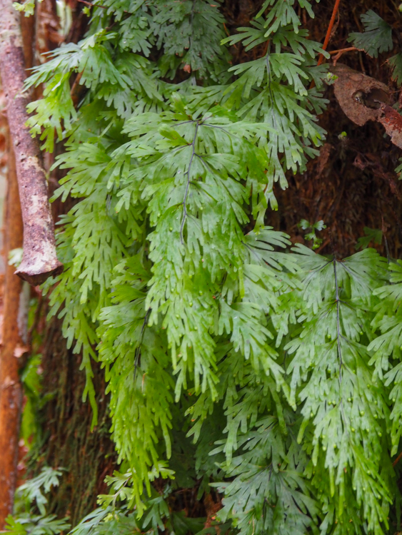
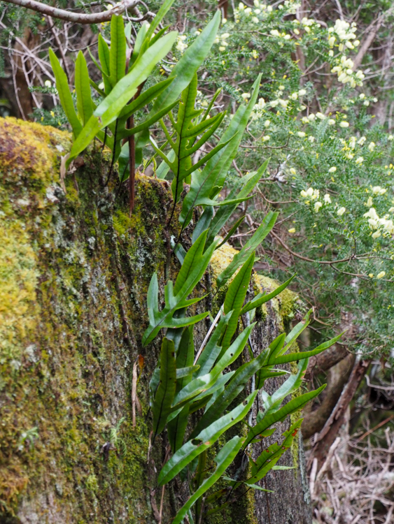
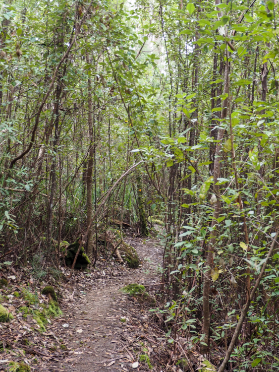
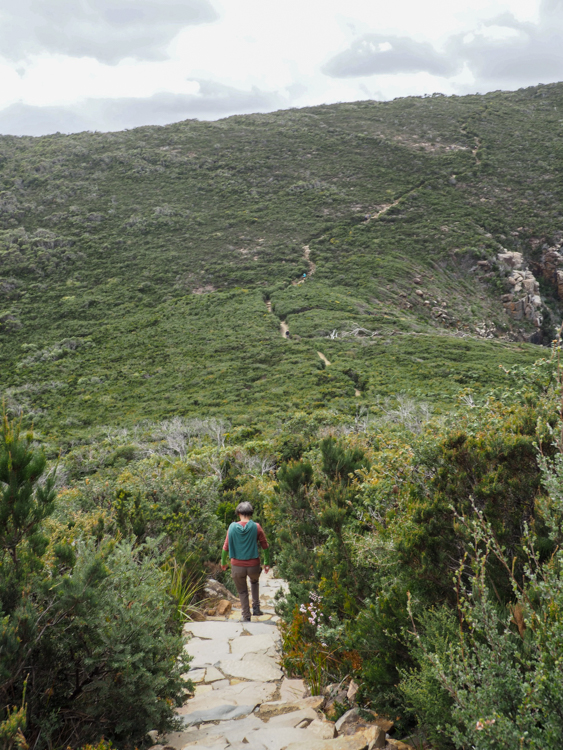
There was rain in the cold and blustery air. We donned our waterproofs and set off. The showery weather matched well with the ecology of this side of the mountain, which tended to drippy rainforest and ferns and moss.

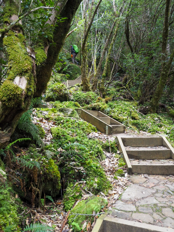
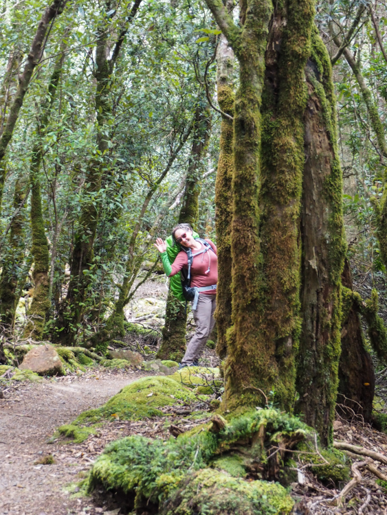
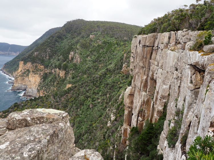
The climb wasn’t as bad as advertised, although there were a lot of steps and it got a bit tiring. However, there were many mosses and ferns to look at, and when we finally got to the top, good although misty views back to yesterday’s Cape Pillar.

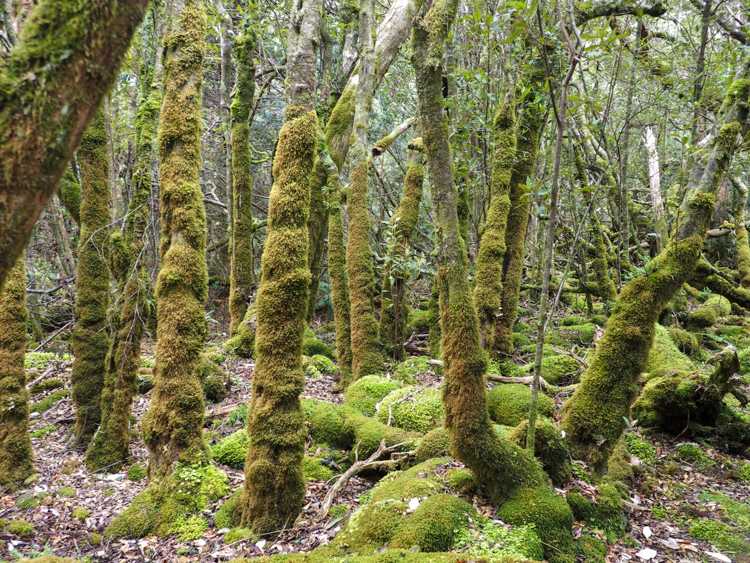
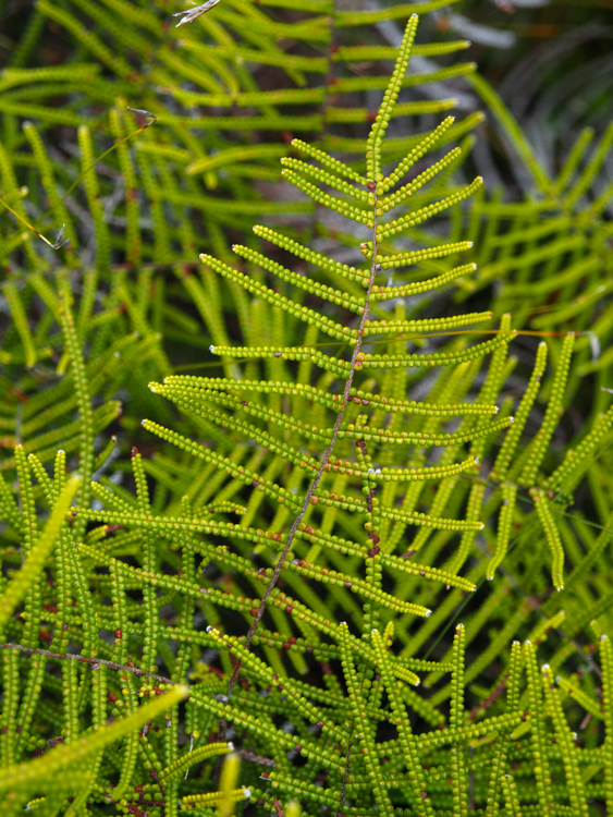
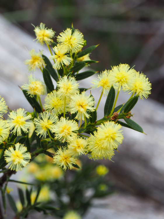
The rain forest environment was quite different from the Banksia and She-Oak ecology that we had experienced on Cape Pillar. There were no Spring flowers here in the gloom, but instead an abundance of ferns and mosses.

We followed the path across the top of Mount Fortescue, and then steps leading down the other side. Abruptly, we emerged from the rain forest into young stands of Sassafras trees

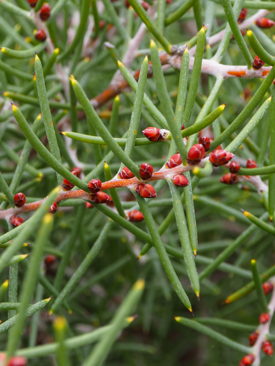
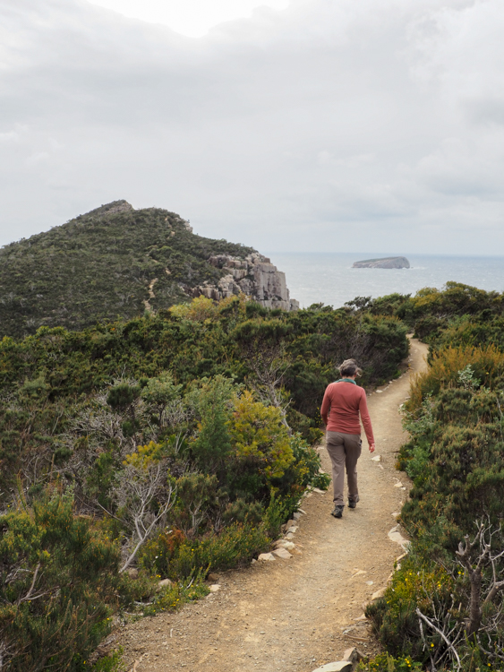
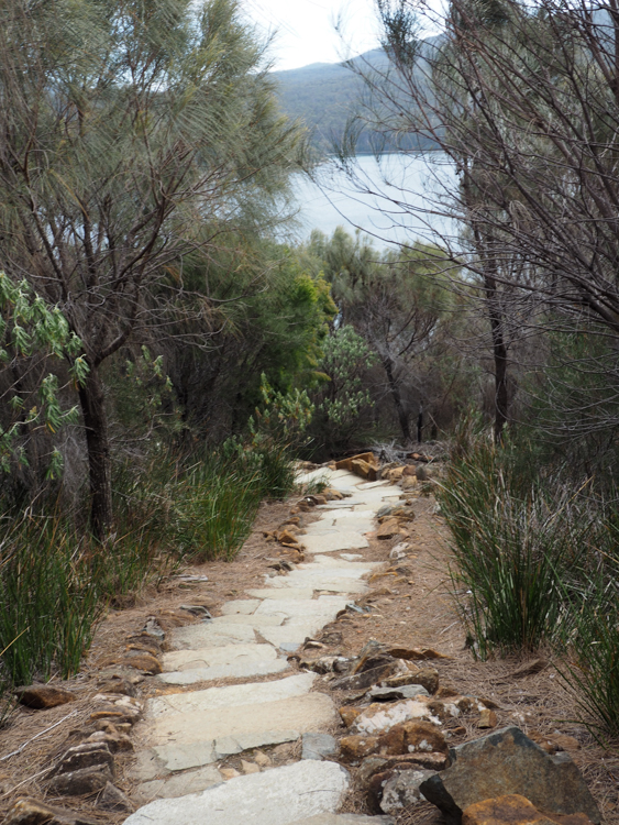
From here, we quickly dropped to a cliff-side path with the more familiar impenetrable jungle of bush plants, scattered with Spring flowers.

The rain had died off, but now the wind picked up. It got pretty blustery out on the exposed rocky outcrops.

Most of the Three Capes Track is private, in the sense that Parks & Wildlife only allow ticketed groups of 50 trekkers at a time, one group per cabin. The only faces that we have seen for the past three days have been familiar from our time on the trail and in the communal areas of the cabins.

The ranger at Retakunna had explicitly warned us that, near the end of Day Four, the Three Capes Track joins the public track to Cape Hauy. He mentioned that many people like to leave their packs at the junction and pick them up on their return, but pointed out that we should be mindful that – if left – they wouldn’t be as secure as we had gotten used to, because there would be other people about. In fact, when we reached the junction and encountered our first group of day-walkers, it was quite a shock to see the first face “not from our village”.

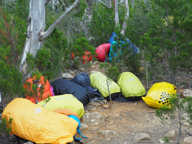
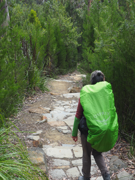
Most people left their packs anyway, wrapped in plastic to confound the currawongs, which apparently are prone to figure out zips and buckles in their quest for food. I carried mine anyway, for the same reasons as yesterday.

The wind was still gusting, but the weather was warm. The track to Cape Hauy is beautifully constructed of local stone, mainly in the form of steps. It was very pretty, but daunting to find that, whenever you turned a corner, there was more track stretching away to the horizon.

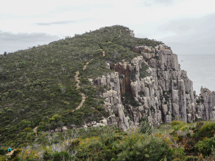
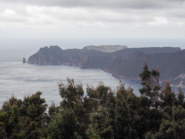
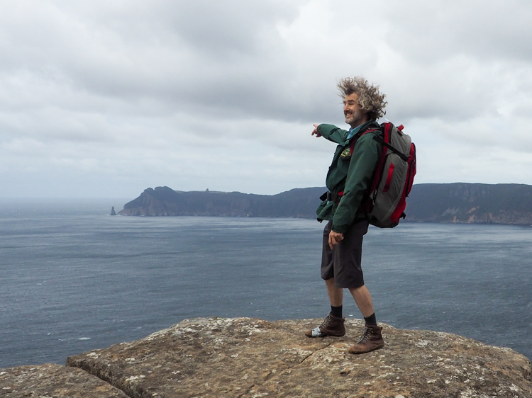
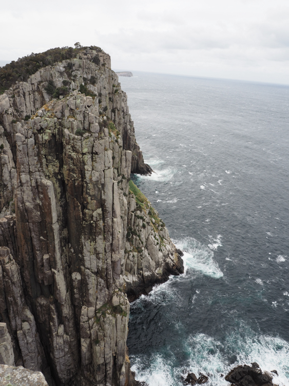
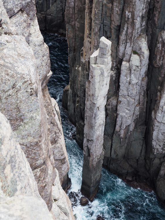
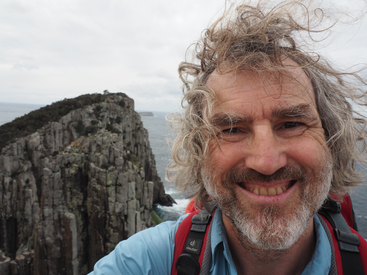
We followed the path until it wound its way to the summit of Cape Hauy. Buffeted by the wind, we stood and admired the dolerite stacks, the views, and some passing whales. Since Cape Hauy is a public area, there is a little guard rail around the top, something that has been deliberately omitted from the controlled parts of the Three Capes Track. Leaning on the rail, facing the mass known as the Candlestick, you can look down on the Totem Pole, popular with climbers.

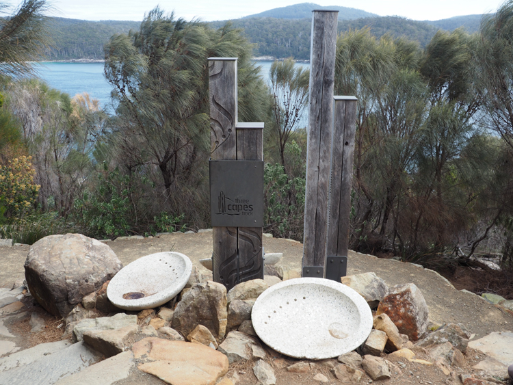
The ascent of Cape Hauy really marks the end of the Three Capes Track experience. From here, it is but a gentle return to sea level at Fortescue Bay.

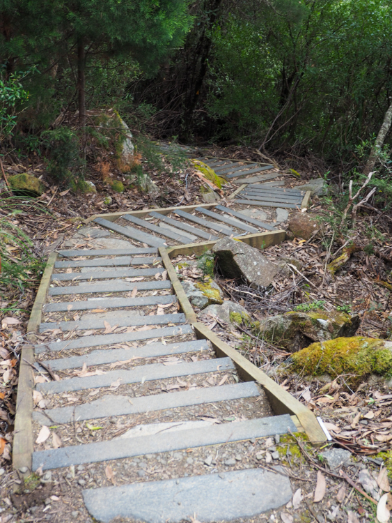
It had been a pleasant experience. Hardly a trek, more of a gently curated four-day amble through the bush. Parks & Wildlife have struck a careful line between tourist attraction and introductory hiking experience, with plenty of interesting tales without dumbing anything down. The paths and boardwalks are a necessary evil which insulate you and hold you aloof from the nature all around, but this is to some extent offset by the deliberate lack of signs, fences and guard rails away from the trail, which would otherwise detract from the wide sweeping vistas. The feeling of being part of a small nomadic village was a pleasant surprise, and enhanced the notion of being away from the stresses of civilisation.

Even though we’d booked ourselves onto the late bus, we made it back to the Bay in time to catch the earlier one, but unfortunately that vehicle had been run off the road by a logging truck. Nobody was hurt, but the bus was now bogged in the roadside verge and couldn’t be moved. Pennicott Adventures did a great job of prioritising the walkers who needed to catch onward services, and used spare buses to ferry us all back to Port Arthur, tired but in good spirits.

Hiking the Three Capes Track – Day Three

I slept well on the second night of the Three Capes Track. I woke naturally at one in the morning, feeling refreshed, and went out for a little walk. Brush-tailed possums stared at me as I pottered about in their night-time territory. An incredibly bright star shone through the cloud layer. I wondered what it was, but it didn’t feel right to get out my phone and launch the star map, so I simply accepted its beauty and walked on.

Eventually I returned to bed, woke at dawn to light rain, and used the ingenious camp shower that I had noticed yesterday. I met Elizabeth in the kitchen and we brewed an Aeropress coffee, followed by fresh fried eggs over reconstituted Mexican beans.

One of the popular features of the third day of the Three Capes Track is that, because it is a there-and-back trip, you can store your pack in a dedicated hut and walk without it. I thought about it for a while, but in the end decided that I was perfectly happy with my pack, which was only a little over 20kg and had everything in it that I needed. I had carefully chosen its contents and I knew how to get to them instantly, so it seemed silly to try to strip it down any more. Just to show willing, I parked my sleeping bag and spare water bottle in the hut, and took everything else.

Day Three takes you out to on the narrow peninsular leading to Cape Pillar, tending to impenetrable Banksia bush on squishy mud. Reg and Tim, the locally famous bush-bashers who had spent several years breaking this trail, had found it very hard going. The ubiquitous boardwalk made it all rather easy for us.

The route is necessarily linear and windswept, and probably a bit miserable when the weather comes in, but today it was bright if overcast, and perfect for walking.

Once the path reached the Southern coastline of the Cape, it began to get rather spectacular, tending to dolomite columns and crumbling stacks.

Tasman Island hove into view, complete with lighthouse. There are harrowing stories about the difficulties of getting families and supplies up the sheer cliffs in the basket of a flying fox, before the light was automated.

Almost at the end of the path, there is a short side-climb up onto The Blade, with marvellous views all around.

And now, the final short stretch to the end of the Cape Pillar Track and the Southernmost point of the Three Capes Track. But just because we were walking through dense Banksia on the thin end of a crumbling rocky peninsula, didn’t mean that there weren’t any more flowers.

But all good things come to an end, and our path ended here, on the cliffs above Cape Pillar.

We ate lunch on one of the stacks overlooking the sea (rice and fish again, it seems to work well), and headed back the way we had come, re-climbing The Blade on the way back (because why not?)

Day 3 was to give us one last surprise. The gentle boardwalk that we remembered lolloping effortlessly down this morning, turned out to be a long, long slope back up to Hurricane Heath, inflexibly hard stretches of boardwalk punctuated by little steps. My hip began to complain loudly for the first time today, and I sneaked some extra pain killers about half way up.

Passing Munro cabin, where we had awoken that morning, we picked up our stuff from the luggage hut, and continued on our way to Retakunna cabin, where the amenities were every bit as delightful as at Surveyors and Munro.

It got a bit cold later on, but we lit the pellet fire to warm the kitchen, then sat and drank coffee laced with rum as the rain came in over the scrubby mountain gums outside.

Hiking the Three Capes Track – Day Two

At the first hut of the Three Capes Track, I had a comfortable night’s rest and woke before dawn. I quietly left the cabin and limped out along the wooden boardwalk to the toilet block, which features beautifully clean dry toilets, the waste dropping into Apollo-shaped pods which are taken away by helicopter.

There was a warm desert wind blowing from the North. My hip was sore from an earlier injury but the painkillers were kicking in, so I did some gentle stretches in the pre-dawn light, and then made my way up to the helipad, which is a simple square of clean gravel at the edge of the compound, to watch the sunrise.

As the first rays of orange moved across the sky, a handful of other people slowly drifted out to stand quietly and widely separated on the pad. Each in our separate bubble of contemplation, we quietly watched the dawn of our first day on the trail. As the sun finally lifted clear of the horizon, the wind changed and brought with it a flurry of rain. Exchanging small private smiles, we sauntered slowly back to the cabins. Time for breakfast.

Elizabeth and I both like to enjoy our first meal of the day, so we had packed half a dozen fresh eggs each as a little luxury. Mine were in their cardboard carton, and one had broken, but it remained salvageable. We scrambled four eggs in ghee with cracked rice in one of the kitchen pans, served with fresh coffee from my Aeropress. Not bad at all.

We washed up, composted the shells, and packed everything else away. The weather outside had turned cool and blustery. We hoisted our packs, and set off.

The second day starts with the ascent of a double peak (Arthurs Peak / Crescent Mountain) connected by a low saddle. I was curious to see how my duff leg was going to cope. It’s only a 200m climb and the path is manicured into stone steps, but I was still a little puffed at the top of the first one. The painkillers and back brace were great, but presumably the tendon was still taking its toll inside.

To take my mind off that, Spring flowers were blooming everywhere, especially the Erect Guineaflower and the local subspecies of Hairy Boronia which is endemic to this peninsula.

Across the saddle to Crescent Mountain, the climb rewarded us with lovely views across the aptly named Crescent Bay, and beyond to Cape Raoul. It is a curiosity of the “Three Capes” Track that it actually follows the perimeter of just two capes, Pillar and Hauy. The third, Raoul, is only ever glimpsed in the distance.

We stopped to admire the view, and then began the climb back down, following a beautifully constructed staircase of local stone.

From the twin peaks, we descended into a flower-laden valley, where yellow-tailed cockatoos feasted on the ubiquitous banksias. The boardwalk made it easy for us, but the first walkers to break trail here spent several years forcing their way through impenetrable Banksia and She-Oak. Much of the work was done by a colourful couple called Reg and Tim, who named many of the features along the way, including ‘Where-the-freaking-hell-are-we Ridge’, which gave this basin its current name, Ellarwey Valley.

Much of the Three Capes Track is now protected by wooden walkways, and these do a great job of keeping everybody to the path and preventing erosion bogs, with the bonus of lifting you a little above the landscape so that you can see over the top of the scrub, but they are tediously hard and flat underfoot.

Today, the valley was beautiful and the Spring flowers delightful, but it was very exposed, and easy to imagine that it would be a harsh trudge if the weather was coming from the Southern Ocean.

At the far end of the basin, we ascended Tornado Ridge where a short side-path led to a series of delightful benches overlooking Tornado Bay. Here we paused and put together a hearty lunch of pre-cooked rice and tinned fish.

Back on the main path, we followed the path alongside the plunging cliffs. A squall came in across Tornado Bay which had us scurrying for our waterproofs, but it swiftly passed by to one side.

The flora varied between wet and dry sclerophyll, but was still sprinkled with Spring blooms. The ground underfoot would have been boggy without the boardwalk. However, the wire-covered hard wooden surface had taken its toll on my boots, and I had to do a swift repair job. Thank goodness for cloth tape.

Arriving at the Munro cabin, we found that it was all pleasantly familiar. Several beautifully appointed fire-resistant buildings holding a variety of kitchens and dormitories. The marked difference was the availability of a hot shower located in the bush. Fill a bucket with hot water from a nearby gas boiler, pour the bucket into the shower bag, hoist it to the sky, and stand beneath! Lovely.

Where Surveyors has a deck for admiring sunsets over Cape Raoul, Munro has a viewing platform, complete with telescope, out over the whale migration route. Humpback whales hung out below for much of the afternoon and then, as dusk fell, a pod of dolphins came inshore to feed in the surf. Wedge-tailed eagles soared overhead.

Tonight’s dinner was reconstituted camp fare, but palatable enough: “Roast lamb and vegetables and mash” followed by rolls of sour cherry paste, with a glass of hot rum tea.

We should have carried more wine, really. The official recommendation was to carry three litres each of water per day, but I had barely touched mine, there would have been room for an extra litre of red instead. One of the other walkers had packed the silvered bag from the inside of a wine box, and had a little party sitting up on the helicopter pad with legs dangling toward the ocean, watching the whales.

Hiking the Three Capes Track – Day One

I have always wanted to walk the Three Capes Track, a four-day hike around the Tasman Peninsula in Tasmania, but it is very popular and tickets are restricted and I never seemed to find the time to sort it out. I was delighted, then, to hear from my good friend Elizabeth that she was flying in the next month to do the trek, and that one of her party had cancelled. I instantly snaffled the spare ticket.

One week before the walk, I was cutting firewood up in my forest when I twisted awkwardly and hurt my leg. For a couple of days it was middling sore, and then it got so bad that I couldn’t sit or lie down, let alone walk. I went for remedial massage at my favourite Chinese doctor, and she did her best but shook her head and told me that I had torn one of the tendons in my hip. She gave me some lovely pain-relief patches which stopped the pain but didn’t help me to walk, and recommended that I buy a back-brace.

Our tickets were for Monday, and it was now Thursday. Off-the-shelf medication was having no effect, although the back-brace allowed me to stand unaided. I had ransacked my medicine cabinets for spare opiates, but none of them touched the incapacitating pain, so I begged my GP to give him something that would allow me to walk. He equipped me with Meloxicam for inflammation and Pregabalin for neuropathic pain. The published side effects were a motley selection, among them “unable to think”, “make bad decisions”, and – my favourite – “hold incorrect beliefs in the face of evidence”. Hiking in the wilderness for four days, what could possible go wrong?

Pregabalin needs a bit of tuning to each individual, so I upped the dose until I could make it through the day. My brain certainly felt a bit soupy, and I had trouble with simple arithmetic. My family told me that I was responding slowly but seemed happier than usual.

By Saturday, I could reliably walk a few tens of metres, so in the evening I strapped on an empty backpack over my back-brace and experimentally walked up and down the street. It was only moderately painful, so I jumped over a small creek. I didn’t fall or cry out. I had 48 kilometres to do next week. I recorded in my diary, “Only two more sleeps. I can do this!”

On Sunday, Elizabeth came to stay, and on Monday we drove over to the Port Arthur Heritage Centre to check in for the walk. Officially we had also purchased tickets for the Heritage Site itself, but there wasn’t really time to do anything about it, so we grabbed a bite to eat instead and joined the other twenty-odd hikers on the sea dock.

Tasmania Parks and Wildlife have joined forces with Pennicott Wilderness Journeys to provide a boat service across the bay to the Tasman Peninsula. I’ve taken Pennicott Wilderness boats several times, and they are always good. My favourite is the Bruny Island cruise, but even though the Three Capes boat is nominally a ferry service, this one didn’t disappoint either.

The actual route across the bay is variable and weather-dependent (or, to be more accurate, swell-dependent, due to the big rollers that typically come in from the Southern Ocean). On our trip, the sea was uncharacteristically smooth, and so we enjoyed a jaunt to see colonies of cormorants and long-nosed fur seals, before arriving at the shelving beach of Denman’s Cove.

The Three Capes Track begins with a sandy wade to shore from the landing-craft style ramp at the bow of the ferry.

The track began between two large rocks at the edge of the beach, with a wooden sculpture. Almost immediately, we found ourselves sharing the path with a small but determined echidna, which wobble alongside us completely unperturbed until distracted by a nice rotten log full of ants.

There were spring flowers everywhere, and we dawdled a bit to admire them, and a selection of views across the water to Port Arthur as the path slowly climbed up toward the cluster of cabins known as ‘Surveyors’.

There were two tempting beaches along the way, not only Denman’s Cove but also Surveyor’s Cove. We knew that we would not be back down at sea level for several days, and it would have been fun to stay and frolic awhile. The water was warm, the sun was strong, and there was very little wind, but the idea of getting to our first stop, the Surveyors Cabin, was equally appealing.

We really hadn’t known what to expect, since the word ‘cabin’ can cover a multitude of sins, but these were spectacular. Spotlessly clean with well-organised bunks, well-equipped camp kitchens, and plenty of space outside to sprawl and admire the sun setting behind the spires of Cape Raoul.

Each cabin is overseen by an on-site warden, who stays in a cabin of their own on the edge of the site. It sounds like an ideal job; they pack in all their supplies, stay for a few days greeting walking parties and cleaning up after them, hike out for a long weekend, then pack in to the next cabin in the cycle.

The ticketing system ensures that there are never more than 48 walkers in one place at one time, which sounds like a lot of people, but in fact it all felt spacious and uncrowded, and it was always possible to find space to put a kettle on or to find somewhere comfortable to sit.

Since the first day was so short and we didn’t have to worry too much about spoilage, Elizabeth and I had elected to bring a one-off meal of steak and wine, and so dined that night in some style. Since we were packing all our food in and rubbish out, the rest of our inventory was freeze-dried to save weight. We ate and chatted, washed up, put the organics in a compost bin, and carefully rolled up the rest of the waste into freezer bags.

There was a well-stocked library and a supply of games, but as dusk fell, most of us drifted off to bed.

My bunk room was calm, dark, and comfortable. There were larger and smaller rooms, and the beds had been allocated according to the demographic of the group. I was sharing with a single man and a father and son; Elizabeth with the ladies and children in the group that she had booked with.

Each bunk was equipped with a foam sleeping pad, and we had all been advised to bring a sleeping bag and ear plugs (as defence against snorers), and to roll up some spare clothes as a pillow.

Tomorrow we would be heading into the thick bush of Cape Pillar. But for now, some rest.

Hiking to Cathedral Rock

Every time I drive over the bridge to approach our new house in Kingston, Tasmania, my eye is drawn to a wedge-shaped pillar of rock sticking up over the horizon. The map shows it as “Cathedral Rock”, part of Mount Wellington National Park, but to me it was a red flag crying “Climb me! Climb me!”

This is the story of the day that I chose to climb up Cathedral Rock. To be clear, it’s not actually a vertical climb, as there is a track. The peak is 880 metres above sea level, and the track starts 600 metres lower than that.

My walk began at the North West Bay River, which is wide and shallow and mainly boulders. There are two starting points, and I tried both of them. There is access up the obvious private road from the car park, but it was more fun to climb down into the trickling river and jump from rock to rock up the river bed. After about half a kilometre, the sides of the ravine dropped to river level, allowing me to rejoin the official path, which was anyway always visible on the left bank.

The Cathedral Rock track at this point is narrow, and easy to see in the sunshine. I thought that it might be a bit hard to follow in darkness or in rain, but wherever there was a change of direction, there was a metal pole with a small fluorescent orange triangle to mark the way.

Despite the fact that it was still following the river, the path very soon began to climb steeply upward between the tree ferns.

I was already starting to feel a little out of breath when one of the orange triangles directed me to turn ninety degrees and walk directly away from the river. The path steepened noticeably, up what appeared to be a flash gully.

After only about half an hour on the trail, the path widened, but the slope was continuous and relentless and I was starting to pant heavily. As I trudged onward, sweat poured down my bowed head and dripped off the end of my nose.

I heard voices behind, and two merrily chatting young couples breezed past as if I was standing still. Cursing under my breath, I wondered if this was the first time in all my life of climbing tall things, that anybody has passed me on the trail. Am I getting old?

I plodded on, through stands of razor-sharp cutting grass. Growing up overseas, I still find this plant fascinating, grass that can hurt you. We have five kinds in Tasmania, and I can never resist checking it with my finger. Blood welled instantly. Yup, still sharp.

Scattered on the ground were the shredded leaves of Silver Wattle which had fallen from overhead. It was late in the year, but when the wattle is in flower, it sends sap to the soft outer leaf shoots to attract Sulphur-Crested Cockatoos. As the birds tear into the stems to feast on the sweet sugary liquid, their wings get dusted with wattle pollen, which they then transfer to the flowers of other trees.

The path kept on climbing. I remarked to myself that, of all the tall things that I have climbed all over the world in all kinds of weather conditions, this little track in the relative cool of the Tasmania Autumn, was up there with the hardest of them.

I really needed a break, but I have a rule about resting on hills. Never rest at the bottom or middle of a hill, only ever rest at the top or on a flat. The idea is to stop at an achievement, and to start on flat ground.

I was dying for a rest, but there was no let-up. The path just angled steeply up, zig-zagging as it went. I was at the point of cursing my own stupid rules, when I rounded a bend and the path became briefly level for about ten blessed metres. Well, almost level. Good enough. I slumped down against a comfortable tree, drank half a litre of water, and closed my eyes for a moment.

Heading up and on, the trail narrowed and, finally, became less steep. Now it was more like walking up a hill, rather than pumping every step with eyes fixed on the end of your boots.

Then, about an hour after starting out, I arrived at the base of the final scramble to the summit. The guides for this walk make no mention of the killer ascent thus far, but wax lyrical about the dangers of the final 400 metres, giving it black diamonds and even a warning sign. I was interested to see just how bad this next part could be! As far as I could see, the track just disappeared up a rocky watershed. What would I find next?

Despite the warnings, the final stretch was just a simple scramble, zig-zagging up a rocky incline with plenty of hand- and foot-holds, nothing at all compared to the hard slog of the endless track below.

The summit was a collection of rocky outcrops, firmly gripped by small stands of Black She-Oak and Needle Bush.

The views were spectacular, all the way South down the Huon Valley, and East toward Bruny Island. I could also look back and see the road outside my house, where I first looked up at this rock and wondered if it was climbable.

It was nice to enjoy the open vistas to the South East, but it was the terrain to the North West that was interesting for future expeditions. Cathedral Rock sits on the cusp of a bowl that surrounds the upper reaches of the North West Bay River. From this altitude, I could see that the river bed up here is similar to the terrain at the bottom, mostly dry with flat rocks. I wondered if it would be possible to follow the river bed all the way up here into the bowl, and then climb out of the far end. The map showed that the river intersects with the Pipeline Track which would take me from Mt Wellington National Park and down into the city.

I also looked around to see if there was a track along the ridge top, because in theory I should be able to follow the edge of the bowl around to Wellington Falls, and before long I stumbled on a thin trail that led over the blade of exposed rock and on to the next outcrop.

I chose not to follow any further on this day. I would need to start a lot earlier to get all the way round, and in any case my car was down at the bottom of the Cathedral Rock track and I had no way of retrieving it if I walked down to Hobart. There is, however, plenty of food for thought for my next trip.

I found a peaceful flat rock to sit on, contemplated the view, and ate some lunch. Then, having sated both mind and body, I began the scramble back down to the track.

As before, the rocky scramble was the easiest part. The long hike back down the steep trail looked simple, but again the relentless slope inflicted a slow muscle burn that didn’t let up until I reached the river.

Still, it’s a beautiful walk, and I will be back.