Every time I drive over the bridge to approach our new house in Kingston, Tasmania, my eye is drawn to a wedge-shaped pillar of rock sticking up over the horizon. The map shows it as “Cathedral Rock”, part of Mount Wellington National Park, but to me it was a red flag crying “Climb me! Climb me!”
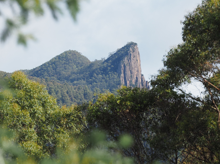
This is the story of the day that I chose to climb up Cathedral Rock. To be clear, it’s not actually a vertical climb, as there is a track. The peak is 880 metres above sea level, and the track starts 600 metres lower than that.
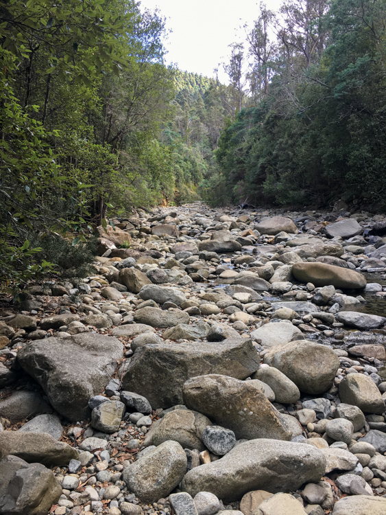
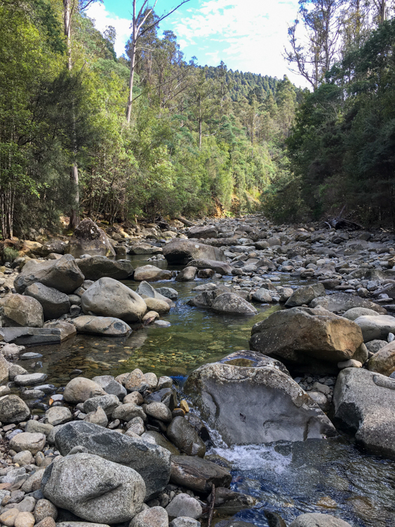
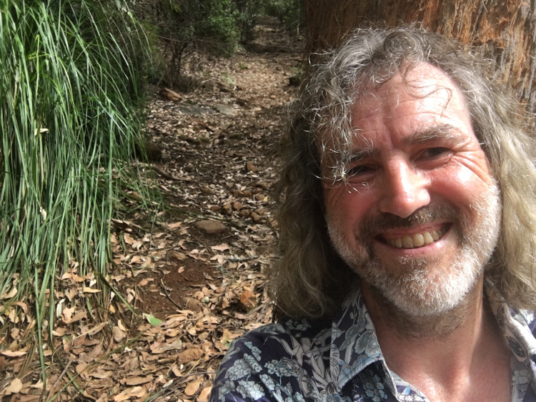
My walk began at the North West Bay River, which is wide and shallow and mainly boulders. There are two starting points, and I tried both of them. There is access up the obvious private road from the car park, but it was more fun to climb down into the trickling river and jump from rock to rock up the river bed. After about half a kilometre, the sides of the ravine dropped to river level, allowing me to rejoin the official path, which was anyway always visible on the left bank.
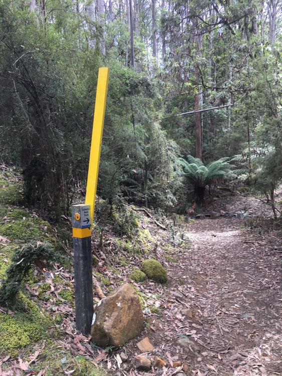
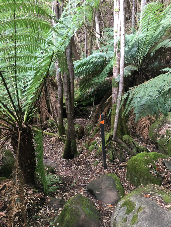
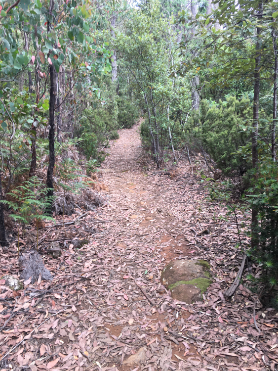
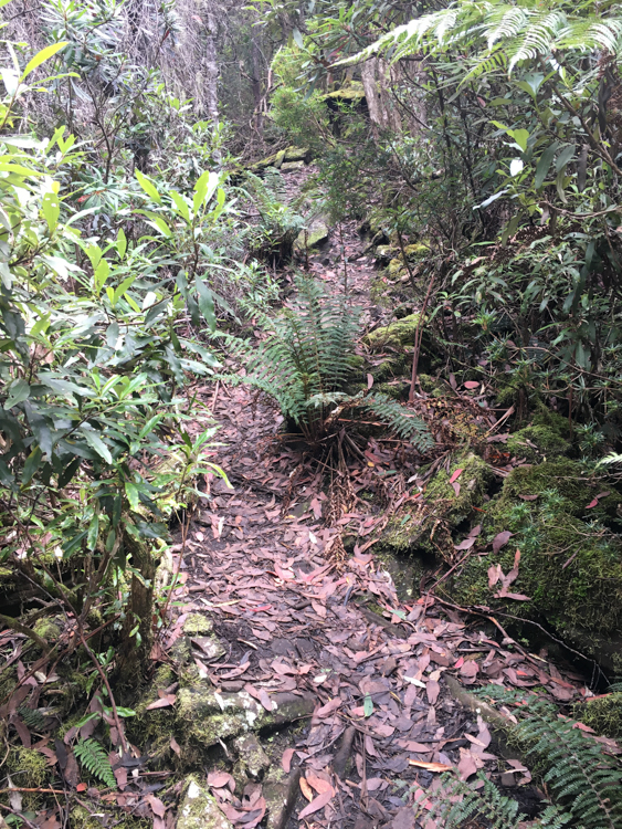
The Cathedral Rock track at this point is narrow, and easy to see in the sunshine. I thought that it might be a bit hard to follow in darkness or in rain, but wherever there was a change of direction, there was a metal pole with a small fluorescent orange triangle to mark the way.
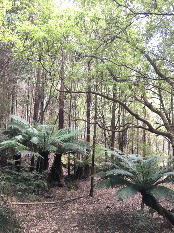
Despite the fact that it was still following the river, the path very soon began to climb steeply upward between the tree ferns.
I was already starting to feel a little out of breath when one of the orange triangles directed me to turn ninety degrees and walk directly away from the river. The path steepened noticeably, up what appeared to be a flash gully.
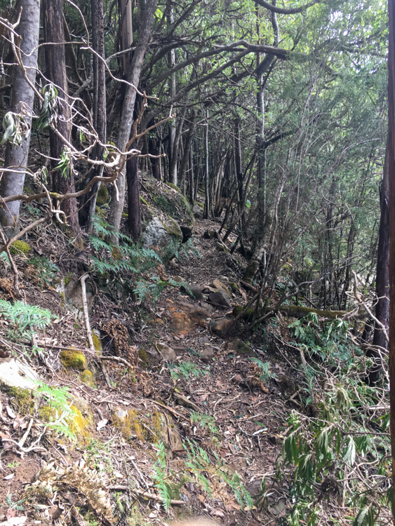
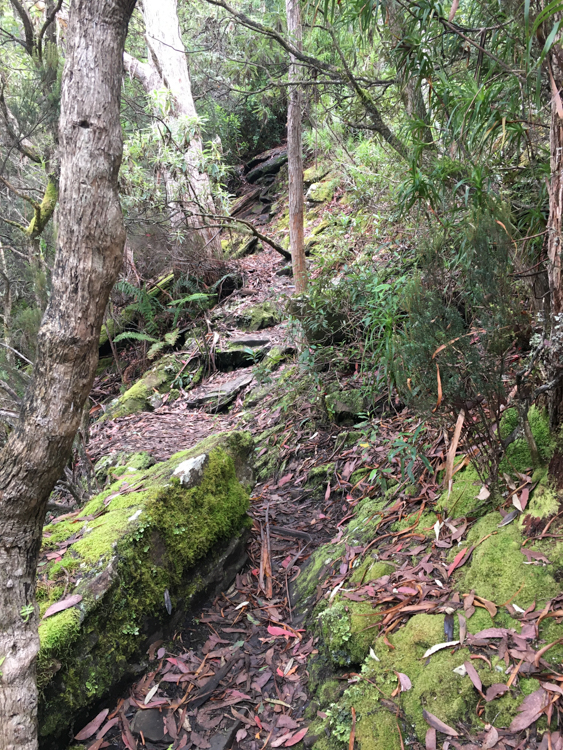
After only about half an hour on the trail, the path widened, but the slope was continuous and relentless and I was starting to pant heavily. As I trudged onward, sweat poured down my bowed head and dripped off the end of my nose.
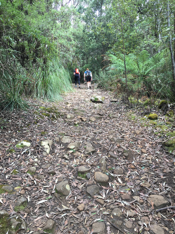
I heard voices behind, and two merrily chatting young couples breezed past as if I was standing still. Cursing under my breath, I wondered if this was the first time in all my life of climbing tall things, that anybody has passed me on the trail. Am I getting old?
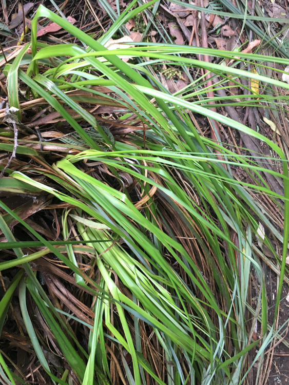
I plodded on, through stands of razor-sharp cutting grass. Growing up overseas, I still find this plant fascinating, grass that can hurt you. We have five kinds in Tasmania, and I can never resist checking it with my finger. Blood welled instantly. Yup, still sharp.
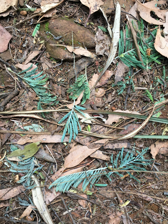
Scattered on the ground were the shredded leaves of Silver Wattle which had fallen from overhead. It was late in the year, but when the wattle is in flower, it sends sap to the soft outer leaf shoots to attract Sulphur-Crested Cockatoos. As the birds tear into the stems to feast on the sweet sugary liquid, their wings get dusted with wattle pollen, which they then transfer to the flowers of other trees.
The path kept on climbing. I remarked to myself that, of all the tall things that I have climbed all over the world in all kinds of weather conditions, this little track in the relative cool of the Tasmania Autumn, was up there with the hardest of them.
I really needed a break, but I have a rule about resting on hills. Never rest at the bottom or middle of a hill, only ever rest at the top or on a flat. The idea is to stop at an achievement, and to start on flat ground.
I was dying for a rest, but there was no let-up. The path just angled steeply up, zig-zagging as it went. I was at the point of cursing my own stupid rules, when I rounded a bend and the path became briefly level for about ten blessed metres. Well, almost level. Good enough. I slumped down against a comfortable tree, drank half a litre of water, and closed my eyes for a moment.
Heading up and on, the trail narrowed and, finally, became less steep. Now it was more like walking up a hill, rather than pumping every step with eyes fixed on the end of your boots.
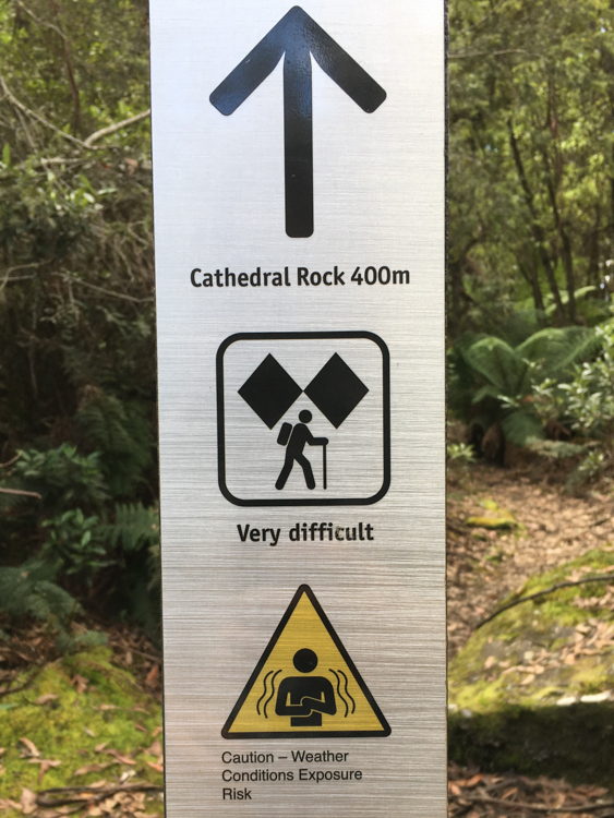
Then, about an hour after starting out, I arrived at the base of the final scramble to the summit. The guides for this walk make no mention of the killer ascent thus far, but wax lyrical about the dangers of the final 400 metres, giving it black diamonds and even a warning sign. I was interested to see just how bad this next part could be! As far as I could see, the track just disappeared up a rocky watershed. What would I find next?
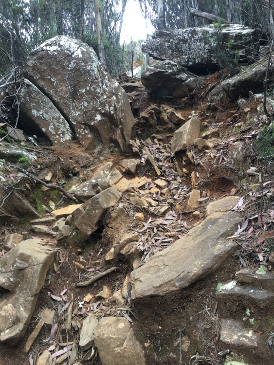
Despite the warnings, the final stretch was just a simple scramble, zig-zagging up a rocky incline with plenty of hand- and foot-holds, nothing at all compared to the hard slog of the endless track below.
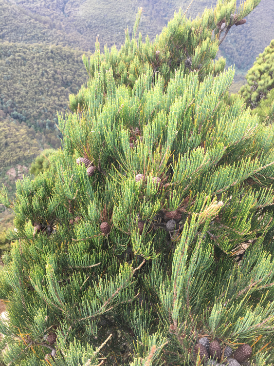
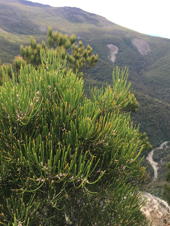
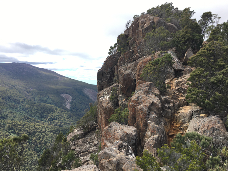
The summit was a collection of rocky outcrops, firmly gripped by small stands of Black She-Oak and Needle Bush.
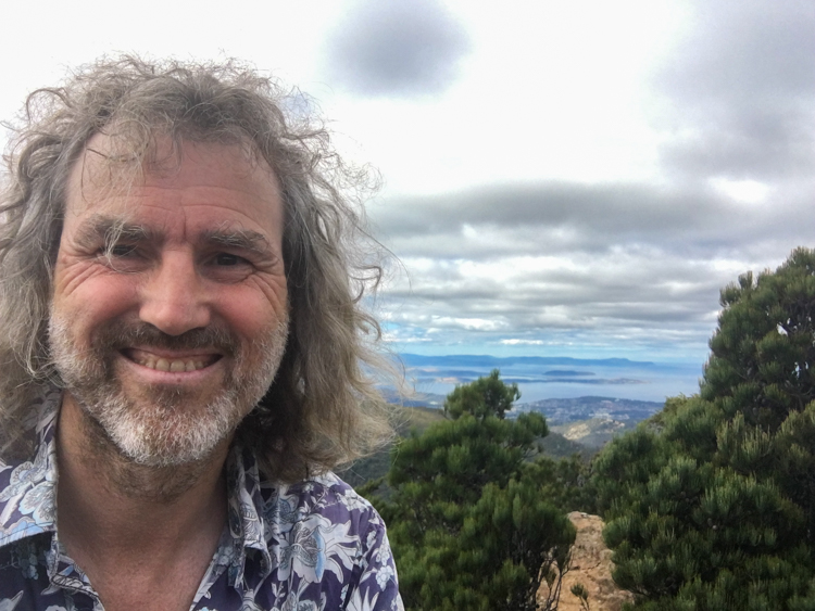
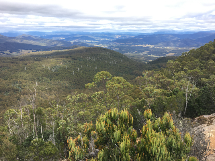
The views were spectacular, all the way south down the Huon Valley, and East toward Bruny Island. I could also look back and see the road outside my house, where I first looked up at this rock and wondered if it was climbable.
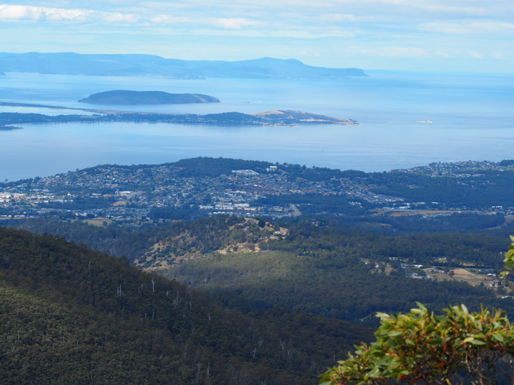
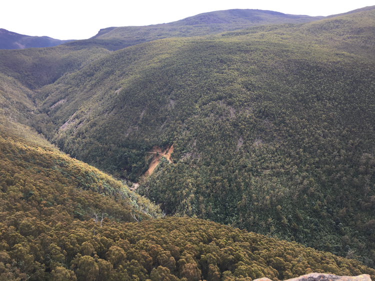
It was nice to enjoy the open vistas to the South East, but it was the terrain to the North West that was interesting for future expeditions. Cathedral Rock sits on the cusp of a bowl that surrounds the upper reaches of the North West Bay River. From this altitude, I could see that the river bed up here is similar to the terrain at the bottom, mostly dry with flat rocks. I wondered if it would be possible to follow the river bed all the way up here into the bowl, and then climb out of the far end. The map showed that the river intersects with the Pipeline Track which would take me from Mt Wellington National Park and down into the city.
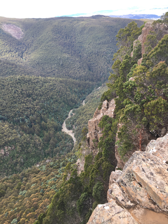
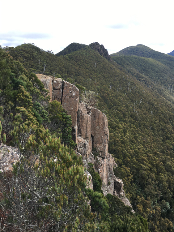
I also looked around to see if there was a track along the ridge top, because in theory I should be able to follow the edge of the bowl around to Wellington Falls, and before long I stumbled on a thin trail that led over the blade of exposed rock and on to the next outcrop.
I chose not to follow any further on this day. I would need to start a lot earlier to get all the way round, and in any case my car was down at the bottom of the Cathedral Rock track and I had no way of retrieving it if I walked down to Hobart. There is, however, plenty of food for thought for my next trip.
I found a peaceful flat rock to sit on, contemplated the view, and ate some lunch. Then, having sated both mind and body, I began the scramble back down to the track.
As before, the rocky scramble was the easiest part. The long hike back down the steep trail looked simple, but again the relentless slope inflicted a slow muscle burn that didn’t let up until I reached the river.
Still, it’s a beautiful walk, and I will be back.