Diving the Mid-Atlantic Ridge

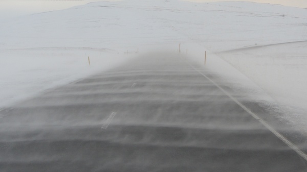
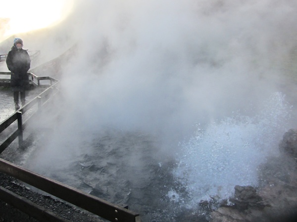
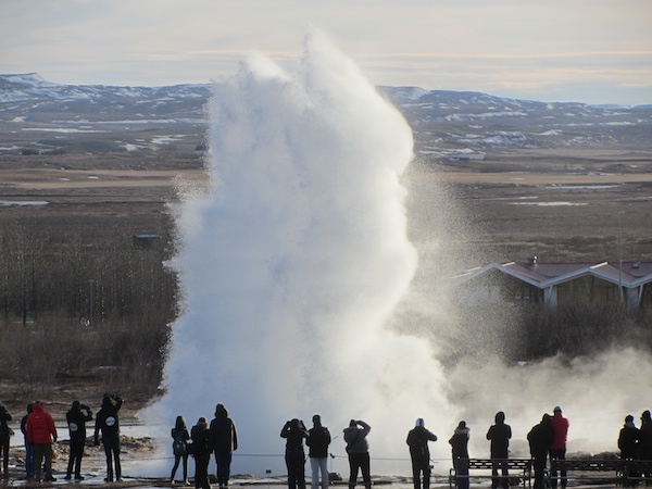
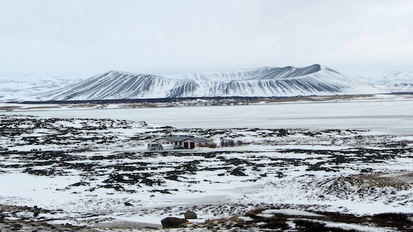
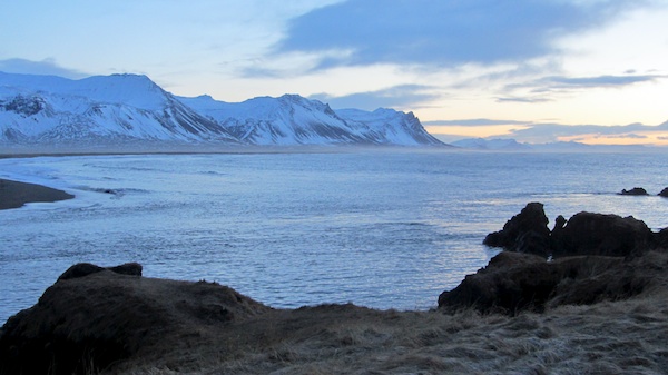
The reason that Iceland exists at all is due to the mid-Atlantic ridge, the boundary between the Eurasian and North American tectonic plates which runs pretty much north-south down the centre of the Atlantic Ocean. The two plates are moving apart at a rate of several centimetres a year, being pushed apart by molten lava welling up between them. Some of this new material gets pushed up above sea level and forms Iceland, which is why the country is so geothermally active – hence the geysers and hot springs.

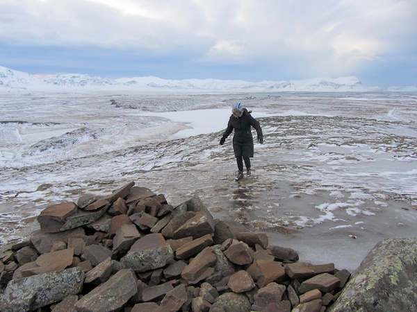
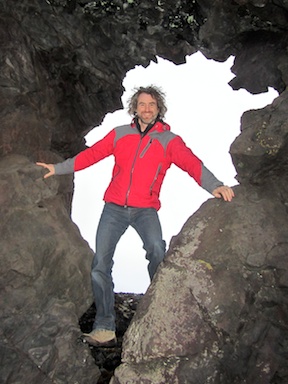
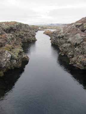
One of the items on my bucket list has always been to visit the mid-Atlantic ridge. I had always vaguely assumed that I would have to get there using some kind of submarine, but I hadn’t realised that the ridge is visible as an identifiable geological construct at Þingvellir in Iceland.

One of the many spreading cracks at þingvellir

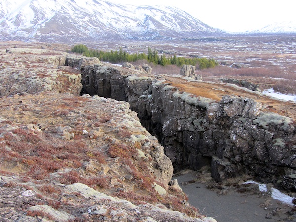
The site is so obviously unique that when, a thousand years ago, the newly formed alliance of Icelandic farmers needed a central place to meet, they chose Þingvellir. For hundreds of years, the Law Rock which sits on the ridge was the site of Iceland’s legal deliberations. In time, wrong-doers were also punished here, usually by being outlawed from society for a fixed period of time, or to duel on an island in the Öxará River. When the country converted from the Norse to the Christian religion – an event which also took place here at Þingvellir – the punishments got more severe, for instance in the case of incest, the man would be beheaded and the woman drowned by being dragged across the lake in a sack. Although the modern parliament now meets elsewhere, important national events are still celebrated here.

The Mid-Atlantic Ridge at þingvellir
Path along the Mid-Atlantic Ridge at þingvellir
Drowning lake at þingvellir
Lake for drownings inside the rift

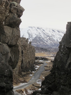
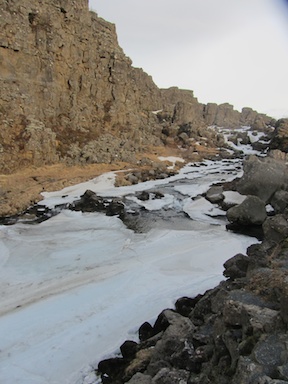
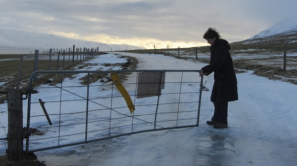
Even though I’d now seen and touched the edges of two neighbouring continental plates, it still didn’t really feel as if I’d properly ticked off the Ridge from my bucket list. I had been thinking about a submarine and instead found myself ambling along a tarmac path with bus-loads of tour groups. Yes it was picturesque and fascinating, but something was missing.

Luckily Bronwyn had already thought of this, and had booked us a scuba dive to the bottom of the Ridge. We were met by the incomparable Nina and Wouter of Scuba Iceland. It’s so nice to occasionally meet up with other travellers who are such kindred spirits. They were taking us down into Silfra Fissure, known to be one of the best fresh-water dive sites in the world, and the closest thing possible to diving between the two continental plates.

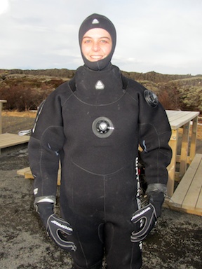
Silfra is part of a river system that drains melt-water into Lake þingvellir, so it’s only a couple of degrees above zero. For this dive we donned thermal underwear, then a fleece under-suit, then a thick neoprene dry-suit. Because of all this additional buoyancy, we also had to carry a lot of extra lead weights, plus big tanks, so getting dressed was quite the process and definitely not a solo affair. Eventually, though, we were ready and staggered down to the start of the fissure.

The Silfra Fissure awaits
Bronwyn half way through dressing for the dive
Bronwyn only half-dressed for the dive

The dive is in three phases. The first part is prosaically named ‘the toilet’ and is a narrow channel along the Ridge. Then there’s The Cathedral, and enormous open space littered with tumbled lava which has fallen from the walls rearing on either side, and finally the Blue Lagoon, which has a deep sandy bottom scattered with freshwater springs. Visibility is crystal clear at 120 metres, and the glacial melt water shades everything a beautiful shade of blue.

copyright Scuba Iceland
The Silfra Fissure. I borrowed this picture from Scuba Iceland, I hope they don’t mind

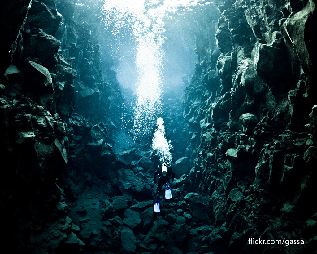
Silfra is a shallow dive, rarely deeper than ten metres. Buoyancy control is always a little hair-trigger on shallow dives. This was my first dry-suit dive, and my first dive in fresh water, so there were a lot of new variables to deal with and I struggled to equalise my buoyancy and ran into a few rocks along the way. Nevertheless I had plenty of time to appreciate the ethereal beauty of the place, as well as occasionally just hanging out in the fissure and thinking, “I’m inside the mid-Atlantic Ridge!”

Waterfalls and Geysers

The journey from the north west to the south west of Iceland takes a couple of days and passes through a number of areas containing waterfalls and geothermal activity. We had intended to make an early start, but got chatting to the nice people at the HestaSport activity centre in Varmahlíð and it was after ten when we finally hit the road.

The initial climb over the pass to Blönduós was beautiful in the sunlight, with fresh powdery snow being blown in ever-moving snake-like patterns across the road and down the frozen river alongside.

Windblown snow snakes

We stopped off at Deildartunguhver, the largest hot spring in Europe and probably the most voluminous hot spring in the world. The flow is now piped off to serve the hot water needs of the neighbouring towns, but there is a long strip of scalded land where boiling water bubbles and spits to the surface.

Bronwyn enjoys a steam bath at Deildartunguhver

Our next stop was at the twin waterfalls Barnafoss and Hraunfossar. The first (‘child falls’) is a narrow ravine which used to flow through stone arches. The story goes that the mother of two children who died there broke the arches to make it safer. The second (‘lava falls’) is quite interesting. It’s not really a waterfall as such, but a line of spring water pouring out from between two strati of lava rock, resulting in a long line of small falls dropping into the river below.

Barnafoss
Barnafoss
Hraunfossar
Hraunfossar

Our room for the night was at an out-of-season golf hotel, the Icelandair Hamar in Borgarnes. It was operating with a skeleton staff, but fortunately one of those was the excellent chef and we once again dined in perfect Icelandic style. This country is a foodie heaven.

We kept the curtains open that night, and were once again treated to a spectacular display of northern lights. It was brief – only about five minutes long – but enormous, with green-tinged arms spreading right up into the sky in a shimmering triangle.

Dawn (10 am!) saw us already on the road, because we needed to put some miles under our belt if we were to tackle the standard Reykjavik tourist trail, the Golden Circle. Passing through Laugarvatn on the way to Geysir we found ourselves feeling a bit peckish. We by-passed several ‘coffee cup’ traffic signs and then found the ‘knife and fork’ which meant a proper restaurant. At the door of Lindin, we were greeted by the owner and head chef, who seated us and presented us with a simple menu of extravagant dishes. We had scored again.

As a starter I had four different carpaccios of game; goose, reindeer, horse and whale, accompanied by a rather excellent goose liver pate. Bronwyn had been hankering for a salad, and although there wasn’t one on the menu, the chef knocked one up from the contents of his greenhouse. For mains, Bronwyn had another of those stunning Icelandic lamb dishes; the lamb here is to die for. I went for an almond-encrusted fillet of arctic char. All wonderful. We left fat and happy.

The eponymous water spout at Geysir no longer performs on a day to day basis, it is only active during earthquakes. Fortunately the nearby Strokkur still runs every eight minutes or so. We watched quite a few cycles, varying from quick bursts to big jets, or even double jets. The thing that surprised me was the short duration of each blow, only a second or so. We entertained ourselves watching other tourists trying to catch the eruptions on film.

Strokkur does its stuff at Geysir

The final waterfall on the Golden Circle tour is Gullfoss, the largest waterfall in Europe. It was by now close to sunset, and the wind chill was seriously bitter, so we scuttled around the falls mummified in layers of fleece and feathers. Gullfoss itself is pretty impressive, with a wide upper fall followed by a second at ninety degrees down into a transverse gorge, all hung about with snow and ice. There is a path down to the waterside, but it was encased in ice and closed for the winter season, so we peered down at the falls from above.

The upper half of Gullfoss
The lower half of Gullfoss

Shivering but content, we hit the road and headed for Reykjavik, where we needed to drop the car off at the rental office. As I pulled out onto the highway, I felt a moment of melancholy that our road trip was nearly over. Then the setting sun peeked out from the clouds and illuminated the snow-covered slopes beside us, and the sadness was lost in a gorgeous pink haze of beauty.

Ice by Tyre, Boot and Tölt

It was time to leave Akureyri and return to the west, but this time we decided to go over the top of the pass rather than back around the coast. It had been snowing quite heavily for several days, so we were a little relieved to wake to blue skies. The snow-ploughs had done a good job, and we got over without any trouble.

Thanks, mate. Good job.

Grettislaug revisited
A few days ago, we tried to get to the geothermal pool at Grettislaug, where legend has it that the outlaw Grettir the Strong warmed up after swimming seven Arctic Ocean kilometres from the island of Drangey. On that occasion our map was incorrect and we ended up on the wrong side of the peninsula.

This time we had better directions. The last section is a minor road which was described as ‘icy but passable’. The road was indeed thick sheet ice, but the spiked tyres held their own. About two kilometres from the pool, there was a farm gate. We got out to open it, and discovered that even though the car was doing tolerably well, we could barely stand on the slippery surface.

Bronwyn gingerly operates a farm gate on treacherous footing

Another half kilometre, and we could see the end of the road down by the sea shore. However, the ice was now stacked in transverse ridges and the car was starting to slide. I was confident that I could safely take us down to the shore, but less sure that I’d be able to get us back up the hill afterwards. For one of the very few times in my life, I chose the risk-averse option, and spun the car round to face back the way we’d come. The only way that we could go further was on foot.

That was far easier said than done. It was impossible to even stand on the road without crampons, which we had neglected to pack. The fields on either side were also iced up, but occasional tufts of yellow hay projected through, and it was possible to very gingerly make progress. After a few hundred metres, we admitted that we’d never make it, certainly not without risking a certain bruising or worse. We turned round and carefully picked our way back to the car.

Looking back at the car, which I've already turned round to face back to the road
Looking back at the car, which I’ve already turned round to face back up the road. This bit’s OK. I suppose I should have taken a picture of the road behind me!

A question of gait
Emma from HestaSport had saddled up some horses for us in nearby Varmahlíð. The Icelandic horse, which resembles a Shetland pony, is the only breed of horse allowed in Iceland, having been introduced here around the 1000 years ago and kept pure ever since. The reason that the rules are so strict is that it is now the only breed of horse that naturally possesses five separate gaits. Elsewhere in the world, two have been lost, modern breeds being only able to trot, canter or gallop. Icelandic horses also have the tölt and the pace. The tölt is fast and yet comfortable because, since only one hoof is on the ground at any one time, there is virtually no up-and-down motion in the saddle. The pace is a very fast sprinting motion where the horse rocks from side to side with both left feet on the ground, then both right.

The ground was icy here, too, but the horses had spiked winter shoes which made them sure-footed even on sheet ice. Emma told us that they are so good on ice that new riders often forget when they dismount, and end up sliding underneath the horse because they can’t stand up. Certainly these horses had no problem negotiating the icy, snowy, tussocky ground.

Crampons for horses!
Mön and Mósa ford the river
There's always something to see in Iceland!
There’s always something new to see in Iceland

On the way back to the stables, Emma showed us how to tölt, and we had some fun changing the pace up and down. It’s a really versatile gait, and you can genuinely just sit in the saddle and let it happen, it’s like floating on a cloud. Why can’t all horses do this?

Heat and Light
HestaSport also have some lovely little cottages on top of a nearby hill, and we had rented one for the night. Our little cabin has 360 degree views and is one of five clustered around a geothermal hot tub. After preparing dinner in our kitchen, we lazed under the stars in the 40 degree water and watched as the first slight haze of the northern lights appeared. There was a clear cold sky so we were hopeful of an auroral display later in the night, but it was too early yet for anything to happen.

Much later, as I was penning this blog with all the lights off and the curtains open, a glimmer of movement caught the corner of my eye. At exactly eleven, a shimmering band of light spread out across half the sky. Streamers shifted abruptly back and forth, searchlights shone brightly into the heavens, and mysterious black bars of anti-light danced back and forth along the shining arc. Half an hour later, the lights went out and it was all over, but we felt privileged to have witnessed the display in this amazing place.

Lake Myvatn

A tale of two waterfalls
Half way from Akureyri and Myvatn is Goðafoss (God’s waterfall), so named because when the region converted to Christianity, the chief threw all the old Viking religious icons over the edge. The snow-storm was blowing a gale, but we arrived just as the sun rose over the mountains and the mist began to clear. Walking tentatively out to the falls, it wasn’t immediately clear which parts of the snowfield were safely laid upon volcanic rock, and which spanned minor tributaries of the river, but we got close enough to have a good look.

Goðafoss
Goðafoss

To complete the set, we also wanted to visit Dettifoss, the highest-volume waterfall in Europe, nominally two hours away by car. The route passed Lake Myvatn and then climbed higher, and ever higher. The road surface vanished beneath drifting snow.

En route to Dettifoss

About 40 minutes shy of the route indicated by our hire car’s GPS, I suddenly hit the brakes. There was a signpost to what was clearly a shorter, better way to the waterfall. I reversed, turned off the highway, and almost immediately came up against a chain slung across the road and a sign, ‘Impassable in winter’. Obviously the computer knew something that we didn’t.

I reversed back onto the highway, and we continued on. The tarmac ran out and we were technically on gravel, but it made little difference because the road was anyway covered in sheet ice. We crossed a tiny little suspension bridge, turned a corner, and piled into a deep snow drift. Another chain. Road closed. We now knew something that the computer didn’t.

The road not travelled

Geothermal Myvatn
Reversing our tracks, we headed back toward Lake Myvatn. The nearby volcano of Krafla has erupted 29 times in recorded history, so the area is full of geothermal features. We stopped off to look at the volcanic fields of Námafjall, a colourful area of steaming rock, bubbling mud pots, and smoking fumaroles. The thermometer claimed 1 degree centigrade, but the wind chill was bitter, and we were glad to warm ourselves by the bubbling vents.

Bronwyn warms her hands
Mud pot at Námafjall

Across the road is a geothermal power station. We discovered that the visitor centre was closed in winter, so we decided to drive up to the volcanic fields of Krafla but the road was blocked by snow and anyway, even if we’d got through, any kind of hiking would have been precluded by the blizzard which was now coming in horizontally.

A snow-covered caldera near Myvatn

The only sensible thing to do was to go swimming, so we headed for Myvatn Nature Baths, a geothermal hot swimming pool. We were warned that because of the strong easterly wind, the western end of the pool was off limits because all the boiling water tends to congregate downwind. We ventured tentatively in that direction, and it was indeed blistering. The rest of the pool, though, was lovely, and the wind was continually churning the water so that there were pockets of warm interspersed with pockets of really hot. There was also a cold swimming lake and a pair of steam rooms. Bliss.

It might be cold out there, but it's warm in here
It might be cold out there, but it’s warm in here

Eventually dusk started to fall, and along with it, more snow. It was an interesting drive back to Akureyri, but we made it down to sea level with only minimal sliding, and were soon tucking in to a good warm fish dinner at the hotel.

Iceland’s Herring Adventure

It was a long drive up to Siglufjördur, Iceland’s northernmost town, but the snow-covered volcanic scenery was beautiful. For several hundred kilometres we had the company of a couple of French hitch-hikers, who were heading to Akureyri to work for their lodgings on a sheep farm. The weather was fine when we picked them up, but the roads became icy as the temperature dropped to zero and I was glad of the studded tyres. We dropped the hikers off as close as we good, but I don’t envy them farm work in this weather.

On the road to Siglufjördur

We were booked in to a little house near to the docks, with clear views of the sky above the fjord. The overnight aurora forecast was good, with high activity and clear skies, but in the end there was no display. The morning, however, brought gale-force winds and freezing rain. We cooked a quick breakfast and then slithered down the road to the Herring Museum. Everything was dark, and more to gain shelter from the sleet than in any real hope, Bronwyn pushed at the door and it opened. Inside we found a hand-bell, which summoned a cheerful man who explained as he unlocked the rest of the museum that they didn’t keep opening hours in winter, they just opened up if anybody showed up.

The museum is a masterpiece, and has already won several awards. It spans three buildings that document the sixty-five years of Iceland’s ‘Herring Adventure’. In the early 1900s, Iceland was the poorest country in Europe. One day, Norwegian fishing trawlers arrived, chasing the herring shoals. Finding good catches, they bought property along the Icelandic coast and began processing their catches there. The locals soon caught on, and sleepy Siglufjördur became a thriving industrial centre, the ‘Atlantic Klondyke’, attracting workers and investors from far and wide. Fortunes were made as the Icelanders took over all of the fishing fleets and built processing plants up and down the coast. The herring industry soon represented at least 25% of the country’s GDP, and post-war Europe became heavily dependent on Icelandic herring meal as animal fodder.

Restored buildings along the old harbour front

Then in the early 1960s, the herring catch began to decrease. Scientists warned of an impending crash, but ‘herring fever’ was in full swing and everybody started building bigger and better trawlers and faster and more mechanised processing plants. This kept supply in line with demand until 1969, when the herring failed to show up. The boom was over, and the herring towns just melted away.

Nevertheless, the entire episode is credited with turning Iceland into a modern industrial nation. Those who had made money in the Herring Adventure employed the newly mobile and motivated work-force and moved into cod and other industries, and the nation prospered. In the early 21st century, the herring even came back.

The Herring Museum consists of three restored warehouse-style buildings. One showcases the offices of a typical herring company, and the accommodation given to the itinerant workers who showed up each year for the herring sorting season. It also houses a couple of very interesting films of the herring catch coming in, one dating back to the early 1930s and the other which was produced for the 1939 New York Expo, which gives you an idea of just how important it was.

Bunks for the herring girls

The second building contains a complete herring processing plant. Any herring that weren’t good enough to be stored whole in barrels, were fed into a factory, where the oil was boiled out and bottled, and the remainder crushed into animal feed.

1950s advert for fish meal animal fodder

The third building is the real jewel in the crown. It contains the most incredible collection of, well, stuff. It’s all contemporary with the Herring Adventure, and includes a fleet of genuine fishing vessels of all sizes, moored up against a simulated dock as if they it’s the middle of the night and they’re waiting for their crews. The superb thing is that it is not organised like a museum, it’s intended to be a complete reconstruction of daily life. You can go anywhere, climb everything, open all the doors, pick things up and look at them. Inside cupboards you’ll find boxes and tins of food, if you lift a bilge hatch you can climb down into the hold and find all the tools and parts that you would expect if you were aboard a 1960s fishing vessel. Scattered around the dock are little workshops and nets being mended, chandleries packed with all sorts of exciting goods. It’s hard to describe what a wonderful treasure trove it is; we had it all to ourselves and spent the entire morning exploring.

Arty picture of our shadows in the fog lamps at Siglufjördur
On deck among the fish holds
Bronwyn mans the galley below decks

The only thing that finally dragged us back to the car was the building gale outside. Somehow the wind sleeting over the roofs of the warehouses was chilling the buildings far below the nominal 2 degrees on the thermometer, and our extremities were starting to freeze as we poked about in one more ‘just let me look in here…’

Bronwyn takes the helm
Our car's parked out there somewhere
Our car’s parked out there somewhere

Somewhat reluctantly we got into the car, and headed out into the blizzard toward Akureyri, which will be our home for the next few days while we explore Lake Myvatn. After a couple of indifferent drinks in our hotel bar, we headed across the street to the incomparable Rub 23 restaurant, where I had minke sashimi followed by five different fish fillets, each flavoured with a different ‘rub’, and Bronwyn had three kinds of fish sashimi (including a beautiful fresh cod) followed by a wonderful slab of ‘sous vide’ beef. To mark the occasion, we splashed out on a bottle of my favourite Meursault wine. A perfect end to a perfect day.

Snæfellsnes Road Trip

There’s a toll tunnel out of Reykjavik, which was thick with smog from traffic fumes. We emerged coughing into the sunrise, which is less impressive than it sounds because sunrise at this time of year is at 10 am. We were heading around Iceland’s ring road for the western peninsula of Snæfellsnes. The GPS in our hired 4WD kept saying “Please take the second exit from the roundabout onto One”, until we turned her off, because there is broadly speaking only one highway of any length on Iceland, which is the One that we were on.

The landscape near the city was rugged with gnarled volcanic rocks dusted with snow, but as we climbed higher we began to see enough forage for the ubiquitous Icelandic ponies.

Icelandic pony
Icelandic pony and small mountain
Another Icelandic pony
Another Icelandic pony and another mountain

Once we arrived at the peninsula, we decided to circumnavigate it anticlockwise, taking in the Snæfellsjökull (glacier) on the way, if the pass happened to be open.

The northern coastline is dotted with little fishing harbours, and we stopped in one for lunch. We ate the local cod, which was fresh and beautifully prepared. The bartender was an ex-fisherman, and I asked him about the depleted cod stocks that had been on the UK news for much of the late 1980s, but he said that as far as they were concerned, there had never been a noticeable cod shortage, and there had always been plenty to be found.

Fishing fleet at Akranes

We had noticed a number of tasteful roadside sculptures along the way, and were rather impressed by some of the modern churches. The one on the hillside above the restaurant had a lovely sweeping modern exterior and a simple Lutheran interior, complete with a beautiful stainless-steel organ and a simple oil painting instead of an altar piece.

The church at Stykkishólm
Stykkishólm village
Stykkishólm village

Further along the road is the little mount of Helgafell, surmounted by a ruined chapel. The local legend goes that if you climb to the top without either speaking or looking back, then you should stand in the ruin, face East and make three wishes. We parked at the bottom and duly began to climb. Presumably it is much easier in the summer! I don’t think that many people attempt this in an icy wind when the ground is frozen and icy, but we did finally make it to the top. Bronwyn did vocalise a little on some of the dicier sections, and I’m not sure if leaning down to lend her my hand counts as ‘looking back’, but we made some wishes anyway. Possibly one of the wishes should have been that there was an easier way down…

Bronwyn slides up the last few yards to the ruin on Helgafell
Helgafell church (and tractor)

Our next intended stop was down a track which we judged too icy even with our studded tyres, so we continued on to the turn-off to the glacier. We quickly encountered a sign which stated in English ‘Impassable’. We checked with a local who was working on his truck, and he said laconically, “Closed. There is snow”. As we drove off, the glacier dumped a blizzard across our windscreen.

The change of route gave us the opportunity to drive on to Djüpaloénssandur and walk down to the black sand beach, which is littered with the remains of a trawler which went ashore in 1948. The wreckage has been left as a monument to those who died, and touchingly it does not seem to have been disturbed except by the sea.

Wreck of the "Epine" on Dritvik Beach
Wreck of the “Epine” on Dritvik Beach
Idiot abroad at Djüpaloénssandur

On this beach are the ‘lifting stones of Dritvik’. These are four large boulders of varying weights alongside a flat waist-high platform. The story goes that if you could pick up the 25kg ‘weakling’ and put it on the platform, then you could work onboard a Dritvik fishing boat in a junior capacity. In order to work as an oarsman, you needed to lift the 54kg ‘half strong’. Bronwyn managed the weakling, I managed the half-strong, but neither of us attempted the 100kg or 154kg weights.

25kg 'The weakling'
25kg ‘The weakling’
54kg 'half-strong'
54kg ‘half-strong’

As dusk was falling, we started to look for restaurants along the way, because we had gained the impression that there wasn’t a restaurant at our next hotel. The few that we found were either closed for the season or not yet open for the evening. In the end, Bronwyn phoned ahead to ask if we could get anything to eat close to the hotel, and they rather tentatively suggested that we should book into their restaurant. Thank goodness that we did! Both the hotel (Hotel Búðir) and the restaurant were stunning. Fine dining overlooking the fjord, with the mountains glowing in the background. The food – an untranslatable local fish – was gorgeous. Afterward we whiled away the evening with locally brewed porters and that typical Icelandic duo of birch-bark liqueurs, Björk and Birkir.

Dawn at the Hotel Búðir